
Large interactive map of a wood open to visit - the Woodland Trust. GCT8PP East Lothian Woodland Walks 2: Binning Wood (Multi-cache) in Southern Scotland, United Kingdom created by Jack Aubrey. I had in mind today to go and get another multi near here for which I have collated the final numbers but haven't yet completed.
However, the high winds caused yet another postponement. One day... Instead, having nipped along to North Berwick, I was heading back out this way when I decided to stop and give further thought to both this cache and the "Binning Wood at Night 2" cache, even though it was mid-afternoon. BikELove - Scotland: Binning Wood & Tyninghame. North Berwick to Dunbar. The John Muir Way is a long distance path named in honour of the Scottish conservationist John Muir, who was born in Dunbar in the 19th Century.
Routes www.RamblersRoutes.org. St Cuthbert's Way, Scottish Walks. This 100 k or 62½ mile walk links the two religious sites in the Border area which are connected with St Cuthbert - Melrose Abbey and Lindisfarne or Holy Island.
In the one, he began his life of religious devotion and, in the other, his life came to an end after long years of service to his God and to his fellow man. This site is intended to give an insight into the places through which the route passes, linking interesting information not normally contained in the guide books, adding scenic views where appropriate and to give pleasure to those who can never share the pleasure of actually being here in the Scottish Borders, whilst encouraging those who can come, to do so. A good map and a guide book, sensible clothing and footwear, and forward planning are essential if you are going to do the real thing; a comfortable chair, and perhaps a refreshment, is enough, if your walk is virtual. Holburn - St Cuthbert's Cave - Swinhoe Lakes walk - northumberland-walks.co.uk (©) Photos between Swinhoe Farm and Swinhoe Lakes, Northumberland Cam (©) These photos were taken on a circular walk from Holburn to St.
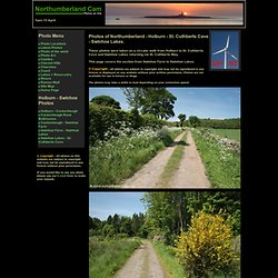
Cuthberts Cave and Swinhoe Lakes returning via St. Cuthberts Way. This page covers the section from Swinhoe Farm to Swinhoe Lakes. © Copyright - All photos are subject to copyright and may not be reproduced in any format or displayed on any website without prior written permission. Walked the dog 3.83 mi on 16/09/2012 in Duns, United Kingdom. Lothian and Borders Group Mailing Lists. Several Groups issue news and updates on walks and other events by email.
In order to receive these email messages, you must be subscribed to the Mailing List for that Group. You may subscribe to as many Mailing Lists as you wish, if you regularly walk with more than one Group. Select one of the Group links on the left for a Subscription form. <p><strong>You must have JavaScript enabled in your browser's preferences in order to display the Subscription Form. You may disable JavaScript again after subscribing</strong>.
Coldstream Group. We are a small, friendly group that walks every other weekend for our longer walks and on the first Wednesday of the month for shorter walks.
Our members come from the eastern Scottish Borders area, from the coast to as far inland as Galashiels and we have a wide range of walks from coastal to the Cheviots, from North Northumberland to the Lammermuirs and much of the Central Borders. We welcome anyone, especially ramblers from other groups and people on holiday in the area. Meeting Points: Henderson Car Park 74:NT844399 (HPCP) and Castle Hotel Car Park 74:NT840397 (CHCP). Walking in Harthope Valley. Harthope Valley.
Broadstruther via Carey Burn walk - northumberland-walks.co.uk(©) The Hirsel Country Park, Coldstream. This well signposted walk explores Dunglass Wood on the Hirsel estate before passing near the Hirsel Lake - home to swans, ducks, geese and many other types of birdlife - on the return.
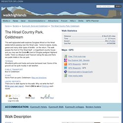
The walk passes the front of The Hirsel itself - a magnificent country house - and you may see the Estates herd of Douglas pedigree Highland Cattle. There is a Museum and Tearoom along the way and there are public toilets in the car park. Terrain Woodland paths and tracks and some tarmaced road. Some of the ground can be quite muddy in wet weather. Public Transport Bus to Coldstream Start Home Park car park, Coldstream.
DUNBAR/HADDINGTON/ ST ABBES. CHIRNSIDE. Heritage Paths - Search for Paths by Map. Thief's Road Start location: unclassified road about 5km.
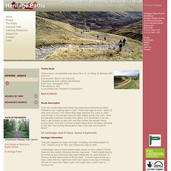
E. of Abbey St Bathans (NT 815 613) End location: B6437 (NT 854 615) Geographical area: Lothian and Borders Path Type: Smugglers' Path Path distance: 4km Accessibility info: Suitable for pedestrians Route Description From the unclassified road follow field edge above Blackhouse Dean Plantation and, keeping wall on right, follow field edge to wood. Gates at both ends of wood, then follow field edge (passing trig. point on other side of wall) to low wooden fence at right angles across the route. Woodhall Dean reserve - Scottish Wildlife Trust. Why visit?
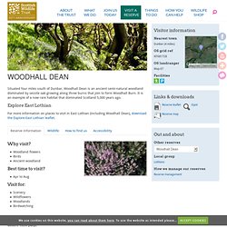
Woodland flowersBirdsAncient woodland Best time to visit? Apr to Aug Visit for: SceneryWildflowersWoodlandsBirdwatching Directions.
Map of Union Canal in City of Edinburgh. Skip to navigation Map key | Location is at 316500,670500 | Click here to convert coordinates. | Click here to toggle map adverts Search Tips. Farm road, Howmuir Running out of Ninewar Wood and through a stripwood. Www.walk4life.info/sites/default/files/walkdocs/walkdoc-6745.pdf. St. Cuthbert's Cave. Creating your walk To begin creating your walk, find the general location of where you would like to create the walk route.
Map controls. Southern Upland Way. Walk Route Map n107 Wooler Common and Happy Valley (High Level Route) from Wooler. Ckburn Law and Edin's Hall broch, Abbey St Bathans. A circular walk with a straightforward ascent of Cockburn Law which offers excellent views over the surrounding Borders countryside and across to the Cheviots. Dowlaw to St Abbs. A gentle start through farmland soon leads on to the most dramatic section of the Berwickshire Coastal Path, leading along the rim of some fabulous cliffs high above the sea. There is a fair amount of up and downhill as the route continues to the National Nature Reserve at St Abb's Head, famed for its seabirds, and on to the fishing village itself. Terrain. The Official Global GPS Cache Hunt Site. Craiglockhart Hills. A short but varied walk within the city of Edinburgh, taking in the peaceful nature reserve of Craiglockhart Woods and the viewpoints of East and Wester Craiglockhart Hills.
Terrain Well-defined earth and aggregate paths, muddy in places. Public Transport There are bus stops on Colinton Road as well as plenty of onstreet parking. Start. Berwickshire Walks. Www.scotways.com/scotways_assets/files/045_lammermuirs_map.pdf. WalkJogRun Running Routes. Helens ayton Running Route created by hkettle- A Google Pedometer.