
AddMagMap examples:Import Garmin maps (complex) 1.
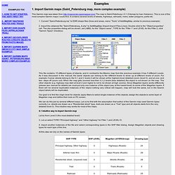
Import Garmin maps (Saint_Petersburg map, more complex example) This Garmin map was taken from The map is Saint-Peterburg v 0.1 (Citymap by Ivan Hobanov). This is one of the most complex Garmin maps I could find. It contains several levels of streets, highways, railroads, rivers, water polygons, parks etc. Converting ESRI .shp file to Garmin .img file. Yes Paul has it right.
I had to make a procedure log for the Mapwel process and was planning on posting it but he beat me. I will include it below since it is more detailed. www.Mapwel.biz my presentation that covers accuracy and the maps in case some wants to see it. Navigon vs. Scout vs. TomTom: iPhone turn-by-turn navigation app shootout! Garmin's Navigon, Telenav's Scout, and TomTom are all excellent GPS turn-by-turn navigation apps available for the iPhone, and all handle navigation, especially the bells and whistles surrounding it, differently.
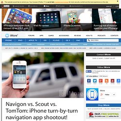
Since turn-by-turn GPS navigation apps are among the few that have maintained higher price points in the app store, so it's not financial viable to simply buy them all and figure out which one works best for you. That's where iMore comes in! We've loaded them up, driven around, and figured out who offers the best all-in-one maps and voice navigation package, and more importantly, which one is best for you! Note: We will be using the U.S. versions of all three apps but all three have many different offerings across several countries.
iPhone Navigation App Comparison Chart. The Best Turn-by-Turn Navigation App for iPhone. Offline maps with custom POIs for iPod Touch/iPhone? - offlinemaps iphone ipodtouch. Offline maps for the iPod Touch/iPhone, and custom points of interest (POIs).
Is there any software that can do this? I'm looking for a piece of software, or some hack for existing software, that will let me 1) view offline maps stored locally on my jailbroken iPod Touch, and 2) load several hundred custom points of interest (POIs). Added level of difficulty: I need to be able to see all of my POIs at once (as simultaneously displayed, clickable map pins) and I have some additional data I'd like to store (latitude, longitude, name, description).
The reason I need this functionality is that I want to be able to pull up my current location when I don't have an internet connection, and see which of my POIs I'm near. I then want to look up a POI in the area and find its address and description. The program xGPS could be another option. Perhaps the best solution could be to use the program OffMaps. Garmin handheld GPS comparison chart. The Garmin handheld GPS comparison chart below shows all current Garmin backcountry and marine handhelds (in alphabetical order) that include a high-sensitivity chipset.
I do not recommend any units without such chipsets for backcountry use. Links go to my Garmin handheld GPS review/resource pages for each model except where I’ve yet to post those; in that case the links go to the Garmin product page. Features in the headers are explained below the chart, while recently discontinued models are shown on a separate page.
GPS for geocachers. POIs & InfoWindows: JavaScript Maps API Developer's Guide. Points of Interest, commonly referred to as POIs, are specific locations that someone may find useful or interesting.
In mapping applications, POIs and InfoWindows are usually paired to visually show locations and location detail. This page covers the creation and stylization of the POI objects and InfoWindows. If you're interested in adding a group of POIs, GeoRSS or KML files to a map, see the Collections and KML and GeoRSS pages. How to Load Custom POIs Into a Garmin Car GPS - Custom POIs. Your Garmin car GPS comes with millions of points-of-interest (POIs) installed, including restaurants, gas stations, businesses, tourist destinations and much more.
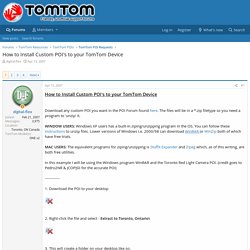
However, many users like to add custom POIs to their GPS devices. These include speed trap and traffic light camera POIs, custom road tours, WiFi hotspots, and more (see links below). Here's how to add custom POI data to your Garmin car GPS. Difficulty: Average Time Required: 10 minutes. How to Install Custom POI's to your TomTom Device. Troubleshooting FAQ Troubleshooting FAQ Q1.
Professional GPS navigation with SDK for fleets. "The partnership between Digitax Automotive Electronics and Sygic allows us to provide a complete and flexible solution for fleet management.

" GPS navigation for smart phones. POI. As an important add-on feature our app allows users to import their own favorite POIs from free sources on the internet like and many other sites.
A POI (Point of Interest) is a dataset containing GPS coordinates that represents interesting and important locations in navigation applications. The most popular POI categories are for example, speed cameras, radars, accommodation locations, restaurants, petrol stations, parking lots, wifi hotspots, attractions, etc. This way you can plan routes to POIs, or be warned by the app when passing by a POI.
Custom Points of Interest for Sygic GPS Navigation What types of files can be imported into the Sygic app: POI database from Mobile Maps app or Sygic Drive (files with .upi extension) POI database from Sygic (files with .rupi extension)) You can also download files in the compatible .upi format directly from You can find instructions how to convert .txt or .csv files to compatible .upi / .rupi format in the section POI Convertor. iPad as a gps. Garmin Oregon Wiki - Waypoints and POIs.
W1.) I've heard the Garmin Oregon supports Waypoints, POIs and Geocaches. How are they different on the Oregon? Waypoints probably don't need any further discussion, they work like waypoints do in just about every other GPS. A Review Of The Garmin Oregon 450t GPS For Field Work: Part I. A few weeks ago, I did a post called “In Search Of The Perfect Fieldwork GPS”, a list of the features I’d like to see in a handheld GPS unit designed for serious fieldwork and mapping.
The Magellan Triton 2000 GPS unit, which I reviewed last year, had some but not all of these features, and while it’s a decent GPS it’s just not good enough for fieldwork. Recently, Garmin was nice enough to send me one of the latest models in their Oregon line of GPS units, the Oregon 450t, for review: This post will look at the basic hardware and GPS performance of this unit, comparing it with the Magellan Triton 2000 and my old-school Garmin 60Cx.
Tomorrow’s post will be a review (rant?) Of the Oregon’s touchscreen interface. The Oregon 450 series, another touchscreen model, is a follow-on to the Oregon 550 models introduced in mid-2009, and the successor to the Oregon 400 series. At 2.25” x 4.25”, the Oregon is substantially smaller than either the Triton or 60Cx, and fits comfortably in my hand. Still Looking For A Good Fieldwork Handheld GPS: A Review Of The Garmin 62s Part I. POI Loader Help. Advanced users can create their own .csv and .gpx data files that include Custom POI lists or TourGuide files on compatible Garmin devices*. POI Loader loads all .csv and .gpx data files saved in a particular directory. When creating or downloading Custom POI data files, it is recommended that you save all the data files you want to upload to your device in the same directory.
POI Loader determines whether or not a file contains speed and proximity alert points based on specific criteria. Use the following information to help you create Custom POI files: Shape File .shp to Garmin .GPX. I have received a Shape not file (.shp) with all the Snowmobile trails for New Brunswick which is approximately 8 meg. I have a Garmin GPS 60 CSx, and would like to be able to load these trails into my 60CSx the same as any other Garmin map set so I can see the snowmobile trails on a map of the province.
The originator of this file uses two or three different types of GPS receivers. A couple are high end ($6000 units) manufactured by Trimble, the other is a cheapy ($300 Canadian Tire version) made by Garmin, model 12. Both of these units will accept shape files. / the originator I have done some reading on this at this site but it makes no sense to me. Create Garmin Custom Map Overlays In ArcGIS Explorer With Garmin Tool. Recent Garmin GPS models (the Colorado, Oregon, Dakota, 62 and 78 series) have the ability to display user-created raster imagery, which Garmin calls “custom map overlays”. Create GPX (gps files) from ArcGIS Shapefiles or GoogleEarth KML files.
Dual Electronics iPad GPS with Bluetooth (Dual XGPS150) - Sporty's Pilot Shop. Www8.garmin.com/manuals/3130_OwnersManual.pdf. Can you remove POI info from a Garmin map? Creating a POI Database Using Google Earth and KML2CSV. ** Guide : Making Garmin Custom Maps ** Download GPSmapper. In the directory "Test Map", find and copy the files "test_pv.txt" and "cgpsmapper.exe" to the folder with your img file. Edit the file to look something like this: [Map] Tutorials & Articles - GPSFileDepot.
GPSFileDepot - Free Custom Garmin Maps, Ximage hosting, tutorials, articles and more for your GPSr. How To Load Maps On My Garmin GPS Unit - GPSFileDepot. Author: Dan Blomberg & Rex Coggins | Last updated March 10th, 2010 at 09:56pm These days many of Garmin’s new GPS receivers contain built in maps, from the nuvi series with road maps to the Colorado and Oregon with topos. These receivers can still have maps loaded to them though in addition to the maps that already exist. Mountn.de. Nuvi GPS Tricks, Tips, Work Arounds, Hints, Secrets and Ideas. -- This is the start of Page 1 -- CLICK FOR OTHER PAGES or use TOC/Menu. iPad vs. Garmin GPSMAP 696 in the Cockpit Trucking. Location Based Services - Garmin Developer. Basic Tips, Hints, Explanations, or Whatnot. For many GPSRs take course as a synonym for track defined below.
So a course in many GPS receivers is the "line" (planned route) from your starting location to the destination or the line from the previous point to the next point which would be a leg of a route. The track in many GPSRs is the direction you are actually traveling over ground. A bearing is the direction from your current location to some other location. The bearing is the direction you would head, if possible, for land navigation.
For instance, if you were in the United States and wanted to take a Mexico vacation, the bearing would read south.