
Historic American Newspapers. Images - The Vietnam I Remember by Steven Curtis. World War I, 1918-1942 : Europe plunges into War. Real History Archives Home Page. Retroland - You Are What You Were. Celebrate Retro Pop Culture At Retroland. Shifting sands reveal World War Two fighter plane lost for 65 years. Last updated at 01:00 15 November 2007 For 65 years, this Second World War fighter had lain hidden under the surface of a beach where it crash-landed. Just a short distance above it, holidaying families have built sandcastles, strolled and swum, all unaware of its existence. But now the P-38 Lightning has re-emerged after freak weather conditions caused the sands to shift and expose its rusting frame. The U.S. aircraft - with its distinctive "twinboom" design - was discovered on the North Wales coast, but the location is being kept secret in case it is targeted by looters. Its remains were spotted by a family in July, but it was thought to be an unmanned drone used for aerial target practice from the 1950s.
However, a local aviation enthusiast recognised it from a newspaper photo and contacted a group of U.S. aircraft historians. The Lightning has been identified using its serial number and other records. It was flown by Second Lieutenant Robert F. Scroll down for more... 50-million-year-old crickets with ears. U.
COLORADO-BOULDER (US) — A new study of cricket and katydid fossils suggests the insects evolved ears long before bats, their major predator, came along. How did insects get their hearing? The 50-million-year-old cricket and katydid fossils sport some of the best-preserved fossil insect ears described to date, and they are helping researchers trace the evolution of the insect ear. Insects hear with help from some very unusual ears, say the collaborators, paleontologist Dena Smith of the University of Colorado Boulder‘s Museum of Natural History and University of Illinois Professor Roy Plotnick. Grasshoppers have ears on their abdomens. Insects have evolved ears at least 17 times in different lineages, says Smith, also an assistant professor in Colorado’s geological sciences department.
Modern insects use their ears to tune in to each other’s chirps, trills, and peeps. Did insect ears get an upgrade when bats came to be? More news from University of Colorado: www.colorado.edu/news/ Welcome to The Ancient Web - The Ancient World's Great Civilizations. The map as history. Antiquity – The Greek world - Mycenaeans - colonization – the Hellenistic kingdoms – a city-state: Athens – Athenian democracy - the Pan-Hellenic sanctuaries – Alexandria, a Hellenistic city – the Greco-Persian wars - Marathon - Salamina – The Peloponnesian war – the Athenian Empire – the conquests of Alexander the Great – Issus – Gaugamela Ancient Greece played a major role in the development of Western civilization and laid down the foundations of democracy.
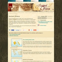
This series evokes Crete and Mycenae, colonization and Greek cities, wars between Persia and the Athenian empire, Sparta and the Peloponnesian war, Alexander's conquests and the Hellenistic kingdoms. In an evolving geographic area, its two thousand years of history have inspired our imagination. The evolving Greek world The Greek world was an ever-changing geographical reality throughout three million years before Christ. Geography of Greece Greece is dominated by two main geographical features: sea and mountains. Colonization Mycenae. World War I Pictures. World War I. Using Old Maps as Tools to Explore Our World. What Is It?
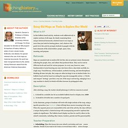
In this bulletin board activity, students work collaboratively to explore sections of old maps. By closely examining these unique historical documents, students learn to see maps as more than just tools for locating places. And, whatever the grade level, this activity prompts students to grapple with the basic elements of the social studies: people, space, time, meaning, and purpose. Rationale Maps are essential tools in modern life but they also are primary source documents reflecting the people, time, and culture that produced them. Description After selecting a map, the teacher should photocopy it with two concerns in mind: It should be a suitable size for an available bulletin board or display area. In the classroom, groups of students will work with single sections of the map, using a specific procedure (see Handout 1) that will help them uncover meaning in the map.
Teacher Preparation Scheduling: Place this lesson into your school’s curriculum and your course calendar. Castle Garden. Ellis Island.