
Welcome - GeoServer. Free GIS mapping programs. Free GIS Datasets - Categorised List. This page contains a categorised list of links to over 300 sites providing freely available geographic datasets - all ready for loading into a Geographic Information System.
We have links to everything from arctic permafrost maps to gridded population data - simply scroll through the list, or use the dropdown menus above to jump to a specific section of interest. See the FAQ for more information on the what, who, how and why of the list. Beware: The data linked to below may be inaccurate, incomplete, or just plain wrong. Free Spatial Data. Country level Download country level data for any country in the world: administrative boundaries, roads, railroads, altitude, land cover, population density.
Global level A new file with the (2011) global country boundaries. There's a wealth of data out there... Bad things happen when problems are protected by a forcefield of tediousness.

Here is an example. Data is the fabric of the modern world: just like we walk down pavements, so we trace routes through data, and build knowledge and products out of it. The government has lots of data that has already been collected, because it has needed it to run the country properly: simple stuff like maps, postcode areas, land ownership, procurement data, endless weather readings, and so on. Right now a fight is happening in Whitehall, with two factions in government: one group thinks we should give this data away for free, as a matter of principle, because it will make good things happen; the other thinks we should restrict access, and sell it. A consultation is under way. As things stand, much everyday government data is locked down so hard that nerds are forbidden to repurpose it. There are areas where access is won by the shame of a simple moral argument. Online and Downloadable Data. ArcGIS Online Map Services Use these map services to create web maps in ArcGIS Online, or access them directly from ArcGIS for Desktop and ArcGIS for Server.
Developers can access them through ArcGIS Web Mapping APIs to build web applications. VMAP0 Map Resources, Mapping Info, Overlay Mapping, SVG Maps. Data Sources for GIS. Public Geodata for the UK. From OSGeo Wiki The following links are to sources of geo-spatial data and is intended for the use of researchers who cannot afford to buy expensive datasets.
Hence, all the datasets are either free or cost under £50.00. Whilst we have included low cost data, it is not our intention to advertise or support companies selling commercial data. Please note the specific licensing restrictions to the data, as specified. In general the data is for non-commercial use only. MAGIC: Summary of dataset download facility. Free GIS Data - GIS Data Depot. MIT Spatial Data. WashU World Wide Data. China Data China Earthquake Geospatial Research Portal Provides gis data for analysis as well as a venue for sharing and distributing resources.
Includes an online map server to visualize and share analyses, posts from the PAICE Mailing List (PAICE = Project for Assessing the Impact of the China Earthquake), and an online discussion forum. World Landsat Data UW Restricted These data are hosted offline until we add enough storage capacity to the website. GeoCover 1990 Near world coverage of satellite imagery from Landsat 4/5 TM 30m 7-4-2. World Elevation Data UW Restricted SRTM (Shuttle Radar Topography Mission) 3 arc second (aprox. 90m) DEM (Digital Elevation Model). World Map Data. Explorer. Data. The United Nations Statistics Division (UNSD) of the Department of Economic and Social Affairs (DESA) launched a new internet based data service for the global user community.
It brings UN statistical databases within easy reach of users through a single entry point. WMO data provide the basis for better understanding the climatology of severe weather and extreme events such as tropical cyclones, El Niño, floods, heat waves, cold waves, droughts and other natural hazards, contributing to saving both lives and property, and improving our understanding and monitoring of the climate system and environment. WMO has drawn attention to issues of major concern, such as ozone layer depletion, global warming, climate change and diminishing water resources. WMO enhances the application of meteorological and hydrological information for the security and well-being of society. Users can now search and download : Data - Are there any free administrative boundaries available as shapefiles? - GIS - Stack Exchange.
Current community your communities Sign up or log in to customize your list. more stack exchange communities Stack Exchange sign up log in tour help Geographic Information Systems Ask Question Take the 2-minute tour ×
Natural Earth. Download data by country. Select and download free geographic (GIS) data for any country in the world Sources Formats The files have been compressed and grouped in ZIP files.
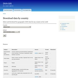
You can use programs such as 7-zip, PKZIP or StuffIt to decompress the files. Free GIS datasets. Socioeconomic Data and Applications Center. Cartographic Boundary Files. What Are They?
The cartographic boundary files are simplified representations of selected geographic areas from the Census Bureau’s MAF/TIGER geographic database. These boundary files are specifically designed for small scale thematic mapping. Generalized boundary files are clipped to a simplified version of the U.S. outline. As a result, some off-shore areas may be excluded from the generalized files. A simplified U.S. outline is available for download for reference (500k, 5m, 20m). For more details about these files, please see our Cartographic Boundary File Description page.