
GPS - NMEA sentence information. Contents [ Top ] [Glenn's GPS Contents Page] 19 Interpreted sentences $GPBOD - Bearing, origin to destination $GPBWC - Bearing and distance to waypoint, great circle $GPGGA - Global Positioning System Fix Data $GPGLL - Geographic position, latitude / longitude $GPGSA - GPS DOP and active satellites $GPGSV - GPS Satellites in view $GPHDT - Heading, True $GPR00 - List of waypoints in currently active route $GPRMA - Recommended minimum specific Loran-C data $GPRMB - Recommended minimum navigation info $GPRMC - Recommended minimum specific GPS/Transit data $GPRTE - Routes $GPTRF - Transit Fix Data $GPSTN - Multiple Data ID $GPVBW - Dual Ground / Water Speed $GPVTG - Track made good and ground speed $GPWPL - Waypoint location $GPXTE - Cross-track error, Measured $GPZDA - Date & Time There is a full list of $GPxxx sentence codes available, without links to format details.
[Top] NMEA MTK checksum calculator. NMEA 2000 CAN Marine Interface Description, NMEA 2000 Pin Out, and Signal Names. An implementation of the Controller Area Network in a marine environment. Serial Data Networking of Marine Electronic Devices NMEA 2000 Bus Description The NMEA Standards Committee developed the NMEA 2000 interface which is based on the electrical CAN Bus [ISO 11898-2 as physical layer].
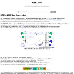
The higher-layer protocol is based on J1939 and ISO 11783. The Controller Area Network (CAN) specification defines the Data Link Layer. In general only the physical layer [mechanical and electrical interfaces] of the OSI model is covered on this site. NMEA2000 NMEA0183 Convertisseur selon. Maretron. Official OpenCPN Homepage. A Chartplotter and GPS Navigation Software.
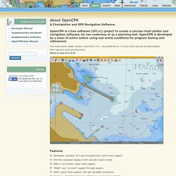
OpenCPN is a free software (GPLv2) project to create a concise chart plotter and navigation software, for use underway or as a planning tool. OpenCPN is developed by a team of active sailors using real world conditions for program testing and refinement. The most recent stable version, OpenCPN 4.4.0, was published on 13 June 2016 and can be downloaded from opencpn.org/ocpn/download.What is new in 4.4.0? Features Worldwide, standard, S57 and encrypted S63 vector chart support. Platforms * Windows XP SP3 , Vista, 7, 8, 8.1 and 10 * Linux, BSD, Solaris * Apple Macintosh OS X Participate OpenCPN is under active development, and we are always looking for contributions such as: The OpenCPN original FAQ Not everyone can contribute with code, but please consider helping out financially.
It'easy to donate through PayPal. It's also possible to find a donate button in OpenCPN. Locate and press in the toolbar. Press the "Donate" button and follow the instructions. Phrases NMEA. APB - La phrase Autopilote format B est envoyée par certains gps pour permettre aux utilisateurs d'utiliser un système de contrôle du pilote automatique.
Cette phrase contient des informations d'alertes. (cross-track-error, waypoint arrival status, initial bearing from origin waypoint to the destination, continuous bearing from present position to destination and recommended heading-to-steer to destination waypoint for the active navigation leg of the journey.) Nota bene : Certains pilotes automatiques comme les Roberson, interprètent l'expression "Relèvement de la destination, vue de l'origine" comme "Relèvement de la destination vue de position actuelle".
Ceci est du aux différences entre la phrase APA et la phrase APB. For the APA sentence this would be the correct thing to do for the data in the same field. Nmea 2000 cables and connectors. Www.nmea.org/Assets/2012 ibex full nmea installation.pdf. Www.molex.com/pdm_docs/sd/848639003_sd.pdf. Www.molex.com/pdm_docs/sd/845860017_sd.pdf. Packetlogger. Freeboard [MeshCMS] FreeBoard is a new way to provide navigation instruments on your boat.
![Freeboard [MeshCMS]](http://cdn.pearltrees.com/s/pic/th/freeboard-meshcms-66845746)
Its released as an open source project (GPL). Its in an early but useable stage, and developing fast. Code is on , NEW: protoype interface board arrives This is the 'floating' view. Goals minimal costmaximum interoperabilitysupport wind, log, autopilot, charts, and other common uses.use low cost commodity hardwaresupport modern devices (PC, tablets, cellphones)support for many simultaneous userstotal system cost (less clients) <USD500use common KAP/BSB or ENC map formats (US NOAA Raster charts work) See OpenSeaMap.org Thats achieved in a totally unique way, by providing the instruments and chartplotter via a web page over a local wifi link on your boat, so that any device with a web browser can access them.
Capabilities Like a PC, Freeboard can do many different things for different needs. Arduino weds Raspberry. The "Freeboard" project. "If you imagine it's possible, someone else is already trying to doing it, or has already done it.
" The Installer. This was how I left my musing on the fictitious open source Celestronic M1 chart plotter system. I wasn't aware at the time how extensive the efforts were by an ever increasing cabal to build these types of systems. My screen display was photoshopped, the ones below are real. Another aspect of the Celestronic story was to illustrate how tentative marine electronics manufacturers have been in adopting new technologies, although this has certainly improved over just the past few years. This all started with a somewhat cryptic comment left on the Celestronic post by "Practical Pirate. " The Raspberry Pi, receives that NMEA data from the Arduino or your current systems via USB, and does real time updating of browser pages accessible to PC's, tablets, and other mobile devices via WiFi.
Now that we have met the Arduino, it's time to talk a bit about shields. Www.ipadnav.fr/fr/docs/MiniPlex-2Wi French.pdf.