
Geography: What is it for? 15f78a52dca0d7ffc0b4f54502b098dd571e81160ce2. This Is Australia - Great Southern Land.
Mapping Australia. Sydney. Climate vs Weather. Australia’s climate data. Human settlement in Australia. Life in Sydney... changes in history. The Blue Mountains. A child’s life in a neighbouring country. Fun Test: The Thing You See First Says A Lot About Your Current Situation. There are a lot of different types of personality tests, some more scientific than others.
While many are very concise, like the Meyers-Briggs personality test, the hallmark of a good online personality test is that it's fun to take! One of my favorite types of personality tests are based optical illusions. An optical illusion is an illusion caused by crossed wires in your brain. Information is gathered by the eye and processed by the brain, but optical illusions can often be very different than how our brains initially perceive them.
There are three types of optical illusion: literal optical illusions that create images different from the objects that make them, cognitive illusions, which are the result of unconscious inferences, and physiological illusions, caused by excessive stimulation of some type or another. Optical Illusion #1 Take a good look at the above image. If you saw a car, that probably means that your freedom is important to you. Optical Illusion #2 Optical Illusion #3.
Australia and Oceania: Maps. No map type or map style is the best.
The best is that Maphill enables you to look at Australia and Oceania from many different angles and perspectives. Technology We automated the entire process of turning geographic data into map graphics. Thanks to that, we are able to create maps in higher quality, faster and cheaper than was possible before. Different perspectives The map of Australia and Oceania in presented in a wide variety of map types and styles. Fast anywhere Maps are served from a large number of servers spread all over the world. Easy to use All maps of Australia and Oceania are available as static images. Vector quality We create each map individually with regard to the characteristics of the map area and the relevant graphic style.
Australia: Physical Features - Map Quiz Game. Bass Strait, Coral Sea, Darling Range, Darling River, Flinders River, Gascoyne River, Gibson Desert, Great Artestian Basin, Great Australian Bight, Great Barrier Reef, Great Dividing Range, Great Sandy Desert, Great Victoria Desert, Gulf of Carpentaria, Hamersley Range, Indian Ocean, Kimberley Plateau, Little Sandy Desert, McDonnell Ranges, Murray River, Nullarbor Plain, Tanami Desert, Tasman Sea, Tasmania, Torres Strait, Victoria River. (26)Create custom quiz 0% | 0:02 | Click on Murray River Australia: Physical Features Your score: undefined% undefined Tell your friends!
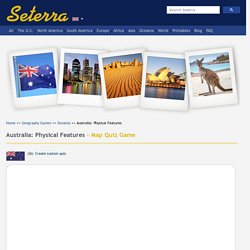
Game mode: Our Science & Geography Channel New! Test your geography knowledge - Australia: physical features quiz. World Map: A clickable map of world countries :-) Home » World Maps » World Map Shown above The map above is a political map of the world centered on Europe and Africa. It shows the location of most of the world's countries and includes their names where space allows. Representing a round earth on a flat map requires some distortion of the geographic features no matter how the map is done. We have used a Mercator projection for this map because it is the projection most commonly used in schools. The map shown here is a terrain relief image of the world with the boundaries of major countries shown as white lines.
This map is also a Mercator projection centered on Europe and Africa. Countries Labeled on the World Country Map: