
Sticky Balsamic Ribs - StumbleUpon. OK, Folks.

No joke, these are the best ribs ever!! I always look at reader reviews when I choose a recipe. They help me decide whether a recipe is worth it, or not. Well, this one had rave reviews...many calling the ribs award-worthy, contest winning, etc. Those words were the truth. Begin with some fresh rosemary. Finely chop 2 tablespoons worth & put it in a mixing bowl. 2 tablespoons of balsamic vinegar & 1 teaspoon of cayenne pepper {I cut back on this a bit, as I was serving this to kids}. Next, peel 8 cloves of garlic. Mince them up & add 1 teaspoon of kosher salt {right on top of the garlic}. Add this to the mixing bowl, along with a 1/2 tablespoon of kosher salt & 1/2 teaspoon pepper and stir everything up. Next, you will need 4 racks of baby back pork ribs.
Preheat the oven to 425 degrees. Cover tightly with foil & roast the ribs until the meat is very tender, about 1 3/4 hours. Add 1 cup of water to the pan & using a wooden spoon, scrape up all the brown bits. Hiking and Backpacking Trail Maps. Hiking Trails, Camping in Parks, Maps and Hotels. Peak to Peak Trail and Wilderness Links. 12 Guy Trips That Will Change Your Life. Digg 1.
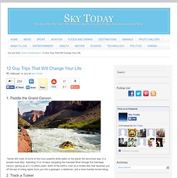
Paddle the Grand Canyon Tackle 300 miles of some of the most powerful white water on the planet the old-school way, in a wooden boat.Why: Spending 13 to 18 days navigating the Colorado River through the mile-deep canyon, gazing up at 2 1/2 billion years’ worth of the earth’s crust on a nimble dory that launches you off the lips of roiling rapids turns you into a geologist, a waterman, and a more humble human being. 2. Track a Tusker The Chyulu Hills of Kenya—the inspiration for Hemingway’s Green Hills of Africa—are where three national parks converge to protect lions, rhinos, elephants, buffalo, and leopards—the big five—and Masai warriors have become its conservationists and guides. 3. The world’s largest mammal can reach lengths of 100 feet (think three school buses) and weigh in at 200 tons—more than an entire herd of elephants. Backpacking versus Thru-hiking @ Backpacking Light. The Longest Mountain Bike Trail In The World MetaEfficient Reviews. Lost Coast Backpacking Trip.
This page is out of date.
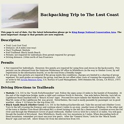
For the latest information please go to King Range National Conservation Area. The most important change is that permits are now required. Description Trail: Lost Cost Trail Distance: 24.8 miles (one way) Start Trailhead: Mattole End Trailhead: Black Sands Beach Permits: not required for individuals (free permit required for groups) Driving distance: 230mi north of San Francisco Permits Not required for Individuals. Driving Directions to Trailheads Mattole: U.S. 101 to the "South Fork/Honeydew" exit. How to travel between trailheads? Car shuttle (leave one car a Mattole, the other at Black Sands Beach). Tides It's very important to have a tide table.
These are the segments that may be impassable at high tide (mileage from Mattole): Punta Gorda (2.9mi) Sea Lion Gulch to Randall Creek (4.5-8.4mi) South end of Miller Flat to 1.5mi North of Gitchell Creek (16.7-20.7mi) Pictures From Phillipe Golle: Route Description. The Ultimate Adventure Bucket List. At the cold upper reaches of the Atlantic, Iceland is marked by the fiery wrath of volcanoes and the cool precision of steamrolling glaciers.
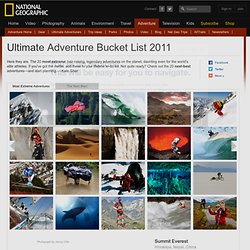
It's also a spot of remarkable instability, situated right on top of the rift between the North American and European tectonic plates. Dubbed Silfra, the fissure is filled with water that, melted from glaciers and filtered through lava fields, is some of the clearest on the planet, often topping 300 feet (91 meters) of visibility. Though the water barely scrapes above freezing, it's a favorite among divers. The dive starts on a nondescript platform in the barren tundra of Thingvellir National Park, a UNESCO World Heritage site.
There, divers squeeze into down-lined drysuits and plunge into the water. Post-dive, emulate the Icelandic people, who spend much of the 20-plus hours of summer daylight in their wild and sparsely populated wildernesses.