
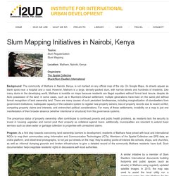
Map Kibera. Map Kibera. Slum Mapping Initiatives in Nairobi, Kenya. Topics: Slum Regularization Slum Mapping Location: Mathare, Nairobi, Kenya Organizers:The Spatial CollectiveShack/Slum Dwellers International Background: The community of Mathare in Nairobi, Kenya, is not marked on any official map of the city.
On Google Maps, its streets appear as blank spots near a hospital and a road. However, Mathare is a large, densely-packed slum, with narrow streets and hundreds of residents. The precarious status of property ownership often contributes to continued poverty and public health problems, as residents lack the security to invest in housing upgrades and cannot post their property as collateral against loans; additionally, municipalities are reluctant to extend basic services such as clean water or garbage collection to properties with unresolved claims. In Kenya, Using Tech To Put An 'Invisible' Slum On The Map : Parallels. The Mathare Valley, shown here in an aerial map, is one of the largest and oldest slums in Nairobi, Kenya.
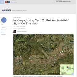
Residents are using hand-held GPS devices to map the area, which comprises 13 villages and is home to nearly 200,000 people. By Making Hand-Drawn Maps of Their Slums in India, Kids Are Influencing Urban Planning Policies. Every kid likes to draw.
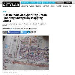
But in India, young people living in slums are using their sketching skills to spur urban change. As part of a broader civic campaign centered on "child clubs," groups of children are creating detailed "social maps" of their marginalized neighborhoods to voice their concerns about public space, as first reported in Citiscope, a CityLab partner site. Since 2011, UNICEF has been encouraging kids to use mobile technology and open data to map environmental and health issues near their homes. But that technology isn't available to everyone. Instead, much of the child-led mapping campaign sweeping India today relies on old-school topography materials—paper and a rainbow-spectrum of markers.
Teams of young mappers and adult facilitators spend roughly 45 days traversing their slums. Shack / Slum Dwellers International. Slums of Urban Bangladesh: Mapping and Census, 2005. Mapping the Slums of Dhaka from 2006 to 2010. Huque final ITC Slum Mapping Bangladesh. Household survey. Mapping Slums in Buenos Aires. Slums house a tenth of the inhabitants of Argentina’s capital, Buenos Aires.
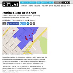
Yet until recently they did not appear on Google or on official maps—and some still don’t. On Google Maps, the neighborhoods may look like gray smudges. When you type their names into the search bar, often, nothing comes up. “Not being on a map has a lot of consequences,” says Mónica Ruejas, an elected representative of the Los Piletones slum. “It creates a lot of difficulties for us.” Sometimes it can even prove fatal. An NGO came up with a straightforward solution: helping residents put their villas, as slums are known in Argentina, on the map. In 2013, the Civil Association for Equality and Justice (ACIJ) created a partnership with the non-profit IT company Wingu and a foundation called Avina and launched Caminos de la Villa (Ways of the Villa). Residents accompanied the project coordinators throughout the villas with handheld GPS devices in order to record every inch of each alleyway. Crowdsourcing 2.0: Why Putting the Slum on a Map is not Enough* There was a time—not too long ago—when informal settlements the size of small cities were practically invisible.
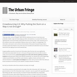
Large and empty beige-gray fields, intercepted by an occasional thin blue line, signifying water, and several thicker, windy white lines that stood for major roads, would pop up on the computer screen when searching for infamous slums such as “Kibera” on Google Maps. The information void stood in stark contrast to the hundreds of thousands of people living in Kibera, ironically tucked away between some of the city’s most valuable and celebrated resources: the Royal Nairobi Golf Club, Ngong Forest and the Nairobi dam. Google-ing Kibera would not reveal much information about the slum, but more significantly, information also lacked within the slum.
In the eyes of the government, the slum did not exist or matter and only few stories, usually about gangs and murders with attention-grabbing sensational headlines bordering sinister hilarity, were deemed newsworthy. Urban Slum Mapping. HSHRC was given the task of conducting mapping of urban slums in order to plan the Urban Health Mission in Haryana.

After making inquiries about the process from other states like Orissa it was decided to do the process by means of GIS mapping. For this work it was decided to involve HARSAC (Haryana Remote Sensing Organization) under the Department of Science and Technology (DST) for which meeting was held with the Principal Secretary of the DST. A proposal was invited from HARSAC for preparation of City Maps. After discussion it was felt that since HARSAC have already prepared digital maps on village boundaries they can also map the political boundaries of each health centre. Mapping the slums. Smart slums: utopian or dystopian vision of the future? Life in a smart city is a frictionless; free of traffic congestion, optimally lit, with everything from bins to buildings constantly reporting their status and managing their interactions with residents.
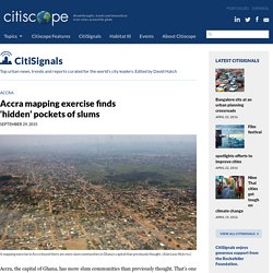
The smart slum is still a peripheral idea, but we can speculate on the likely impact of extending this ‘smartness’ to slums and make two competing claims. Firstly, that development professionals should be wary of smart slums repeating some of the negative impacts of ICT4D; and secondly, that a push for smart slums could be appropriated for social justice. The idea of the smart city is a vision of a networked urbanism. The promise is that environmental monitoring and feedback from embedded sensors everywhere will simultaneously deliver greener and more productive cities. The idea has been most fully materialised in brand new cities like Songdo in South Korea but is spreading to established urban centres like San Francisco, Amsterdam and Madrid. Accra mapping exercise finds ‘hidden’ pockets of slums. A mapping exercise in Accra found there are more slum communities in Ghana's capital than previously thought.
(Alan Lew/flickr/cc) History, Travel, Arts, Science, People, Places. SRA to physically map Mumbai slums. Written by MANASI PHADKE | Mumbai | Updated: June 2, 2015 6:24 am The SRA has tied up with state-run MahaOnline for a one-month pilot to record eligibility in a few slum clusters.
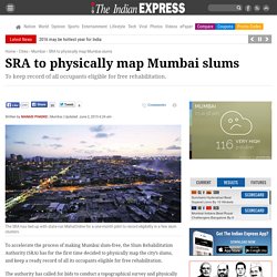
To accelerate the process of making Mumbai slum-free, the Slum Rehabilitation Authority (SRA) has for the first time decided to physically map the city’s slums, and keep a ready record of all its occupants eligible for free rehabilitation. The authority has called for bids to conduct a topographical survey and physically mark the boundaries of all slum clusters in Mumbai. It has also tied up with state-run MahaOnline to conduct a one-month pilot to record eligibility in a few slum clusters. The state government has recently issued fresh instructions to determine the eligibility of slum dwellers for rehabilitation as per its latest cut-off date, which protects all slum structures built before January 1, 2000. Share This Article “We hope to complete the mapping within six months. Mapping of environs of Dharavi slums of Greater Bombay for site suitability using enhanced Landsat thematic mapper (TM) imagery.