
Texas A&M Geocoder - Free online geocoding. Geocoding Services Make that address data work for you If you want to turn that address data of yours into latitude longitude values, you have come to the right place.
Geocoding is what we do, full time. Seriously. QCRI develops automated Geotagger for the World Bank. Qatar Computing Research Institute (QCRI) has developed a system for the World Bank that automates the geocoding of all Bank-financed projects.
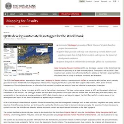
The system, built by QCRI’s Data Analytics team, enables more efficient and effective labeling of the Bank’s project portfolios and places them on a map for analysis, monitoring and evaluation. The QCRI GeoTagger platform augments the World Bank’s Mapping for Results initiative, a partnership with AidData, a partnership with AidData, which manually geocoded all active World Bank-financed projects in 144 countries. Mapping for Results is part of the Bank’s Open Data initiative, which allows for more transparency of its activities and access to information that promises to produce new analysis, tools and solutions to development challenges.
Patrick Meier, Director of Social Innovation at QCRI, said of the Institute’s involvement, “We have a strong social mission at QCRI and this project reflects our commitment to that mission. List of Online Geocoding Systems. The Texas A&M Geoservices Geocoder is a work in progress that functions well in many cases but may fall short in others.
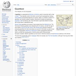
As more development takes place we hope to increase the former and decrease the later. If you find our service does not meet your needs, the following list of available geocoders can guide you toward other available options. Last updated - July 1, 2013. Gazetteer. The Santa Fe Railway's 1891 Route Map, entitled Grain Dealers and Shippers Gazetteer The word was occasionally used in newspaper titles (for example, see The York Gazetteer), although it has long since fallen out of fashion.
[original research?] Etymology[edit] Thesaurus of Geographic Names. Search Tips For the Find Name field, you may use AND and OR [e.g., 1) san carlos, 2) carlos OR charles, 3) carl* OR charl*, 4) san AND carlos, 5) carlos AND (san OR saint), 6) (carlos OR charles) AND (san OR saint)] Boolean operators must be in all caps (AND and OR).
Wildcard is the asterisk (*); right truncation only. To find an exact match rather than a key word, use quotes [e.g., "carlos"]. There is an implied AND between the Find Name, Place Type, and Nation fields. About the TGNLearn about the purpose, scope and structure of the TGN. The TGN is an evolving vocabulary, growing and changing thanks to contributions from Getty projects and other institutions. F.A.Q. about the TGNHere you will find a list of the most frequently asked questions about the thesaurus. Alexandria Digital Library Project.
World Gazetteer: World Gazetteer home. 30 mars 2015 - Algérie : 39,5 millions d'habitants L'Office national des statistiques d'Algérie a publié une mise à jour de la population du pays au 1er janvier 2015.
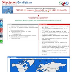
L'Algérie compte donc actuellement environ 39,5 millions d'habitants, et la croissance démographique s'est même accélérée ces dernières années. 28 mars 2015 - Le Yémen replonge dans la guerre Plus de 25 ans après sa réunification, le Yémen est à nouveau plongé en pleine guerre. Rebelles Houthis soutenus par l'Iran et qui tentent de conquérir militairement une partie du territoire ; autorités en exil à Aden soutenues par l'Arabie saoudite et ses alliés sunnites ainsi que les États-Unis réunis au sein d'une coalition internationale ; groupes terroristes comme l'Organisation de l'État islamique (OEI) et Al-Qaïda dans la péninsule arabique (AQPA), qui exercent elles aussi des pressions armées et violemment meurtrières.
Avec au milieu les populations civiles. GNS Home. BGN: Domestic Names - Main. The Geographic Names Information System (GNIS) is the Federal and national standard for geographic nomenclature.
The U.S. Geological Survey developed the GNIS in support of the U.S. Board on Geographic Names as the official repository of domestic geographic names data, the official vehicle for geographic names use by all departments of the Federal Government, and the source for applying geographic names to Federal electronic and printed products. The GNIS contains information about physical and cultural geographic features of all types in the United States, associated areas, and Antarctica, current and historical, but not including roads and highways.
The database holds the Federally recognized name of each feature and defines the feature location by state, county, USGS topographic map, and geographic coordinates. The Google Geocoding API - Google Maps API Web Services. The Google Maps Geocoding API is a service that provides geocoding and reverse geocoding of addresses.
BOSS Geo Services. Yahoo BOSS Geo Services Yahoo BOSS is a suite of services that provides Developers premium API's that can support Search and Geo applications.
BOSS Geo services include two primary offerings today, Placefinder and PlaceSpotter, which allows developers to geo-enrich their applications and make them more location aware. Learn more about the offerings below. How Do I Get Started?