New York City's Water Supply System. StreamStats in New York. StreamStats for New York can be used to estimate (1) instantaneous flood discharges with exceedance probabilities of 0.8, 0.667, 0.5, 0.2, 0.1, 0.04, 0.02, 0.01, 0.005, and 0.002 (1.25-, 1.5-, 2-, 5-, 10-, 25-, 50-, 100-, and 500-year recurrence intervals, respectively) for ungaged, unregulated, rural streams throughout New York; (2) bankfull discharge and channel characteristics of streams throughout New York.

The reports below present the regression equations used to estimate these statistics, and describes the methods used to develop the equations and to measure the basin characteristics used in the equations. Users should familiarize themselves with the reports before using StreamStats to obtain estimates of streamflow statistics for ungaged sites. General information on the Interactive Map application, as well as specific sources and computation methods for basin characteristics are available here. Contact Us if you experience any problems with this application.
OASIS. Open Accessible Space Information System The Watershed OASIS provides information regarding outdoor recreation opportunities and educational facilities in the Catskill/Delaware and Croton watershed regions of New York State.

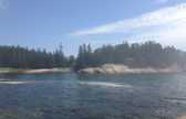
These watersheds provide clean, safe drinking water for residents of New York City and the surrounding communities.