

360度環景攝影. Research Image Composite Editor (ICE) Texas Stadium Implosion - BigLook360. The death of an iconic stadium and an Immersive Media Dodeca 2360 Spherical Video Camera.
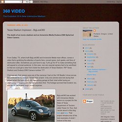
From Dallas, TX, where both BigLook360 and Immersive Media have offices, comes a video that is grabbing the attention of sports fans, concert goers, tech geeks, and fans of destruction alike. Sometimes you just have to say, "Let's go for it! " to make something that will appeal to a broad audience. In this case, one very special camera had to be sacrificed so that we could get a view from inside the destruction of Texas Stadium.
RIP Texas Stadium and Dodeca 2360 Camera number ??? Chances are, that camera was one of the cameras I had on the VW Beetle I drove across the continent for the Google Street View project. 多維空間資訊有限公司. Riding Shotgun With Google Street View’s Revolutionary Camera. For the past seven months, Kevin Nanzer has been on the road almost nonstop, living in and out of motel rooms and corporate apartments.
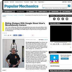
He's crisscrossed the country, living for weeks at a time in cities like Austin, Texas, Oklahoma City, Okla., Raleigh, N.C., and Albany, N.Y. Nanzer, 23, is a geoimmersive data producer for Immersive Media, a Canadian company that specializes in the fast-growing world of "spherical video"—aka mapping the world for Google and beyond. For 5 hours each day (the most he can film because of the sun's angle to the Earth), Nanzer and a co-worker drive anywhere from 80 to 200 miles through a major city, capturing video and location data of every single street, bridge and highway.
"By the end, you'll get to know the city better than the one you grew up in," he says. "You can call me if you're lost in Oklahoma City, and I can tell you how to get somewhere. Cameras Archives. April 02, 2009 my Technomadic Hacks in Cyberpunk Non-Fiction; "C/Punk/Doc" I met Laszlo Kovacs, Director of C/Punk/Doc through the amazing forums @ Cyberpunk Review.
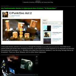
He invited me to submit media just as they were wrapping production, so we have a 1.5 minute segment on my Wearable and Nomadic Computing work that begins Act 2. Narration is by Hawk from American Gladiators, over the song Teenage Hitman by Encephalon. » Papervision3D CornFlex, Script by Q. FLARToolKit: AS3 Augmented Reality Written by Quentin LengeléPosted in Flash,Papervision3DMarch 25, 2009 Months ago, I saw lots of video examples on blogs and YouTube and finally I got some time and found AS3 sources from some brilliant japanese guys (Libspark).
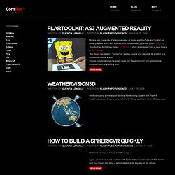
They built an AS3 library called FLARToolKit which is translated from a Java library (NyARToolkit). This library can detect a “marker” on a video source and calculate its position in a three-dimensional space. Theses coordinates can be easily used with Papervision3D and applied on a Collada Object or anything else. Read more WeatherVision3D. How Does Google Create Street View? Shooting 360-degree video with four GoPro HD Hero cameras. Posted by ryanjackson on Feb 8, 2011 in 360 Panoramas, DIY, photos, training, video | First off, watch my 360-degree Video of the World Record Dodgeball Game at the U of A So last year I shot this video of the University of Alberta setting a world record for most people playing dodgeball and the video got over 650,000 hits.

I’ve seen a few 360-degree videos out there but not as many as you would think considering how freaking cool they are. Since 360-degree videos is pretty uncharted territory in the photojournalism world I absolutely had to take the challenge. To shoot my 360-degree dodgeball video I used four GoPro Hero HD cameras on 1280×960 mode mounted vertically. The short version of this story is that I shot with four GoPros, extracted still images from video, stitched the stills together into panoramas then recombined them back into video. For the much more detailed and nerdy answer read on…. Here was my shooting process. Hit record on my Olympus LS-10 PCM recorder.
I say. DIY Street-View Camera. If you use Google Maps, you're probably familiar with its Street View feature, which shows actual ground-level photos of many cities around the world.
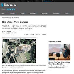
Google creates the images by mounting special cameras on vehicles and driving them around. Now wouldn't it be great if you could have your own Street View–like camera? You could hike a trail and later share the photos with friends. The photos would carry GPS tags, so you could display them on Google Earth and include annotations—good water here, poison ivy there. Realtors could display whole neighborhoods to potential clients. Last year, as part of a "disruptive technologies" course at the United States Military Academy, in West Point, N.Y., I set out to develop a prototype.
For the camera system, I chose the Microsoft LifeCam NX-6000, which is small and has UVC (USB video class) compatibility. The NX-6000 has a lens with a 71-degree field of view. Construction was straightforward. The images also need to be GPS-tagged. 一探Google Maps街景地圖與Google街景車秘辛. Google罕見地在西門町紅樓廣場舉辦Google Maps記者會,並且將在台灣四處趴趴走的Google街景車全部召喚到齊,這可是千載難逢的機會,T客邦也拍了許多Goole街景車照片、問了許多問題,讓大家了解Google街景服務其中的秘密。

▲一字排開的Google街景車陣容,其中一台還在外頭等著進場。 台灣的Google Maps街景服務是從2009年8月開始上線,截至目前為止已經涵蓋台灣14個縣市、共10萬公里的實景街景圖,換算可以繞台灣100圈、繞世界2圈半。 目前上線的街景服務城市包含台北縣市、基隆市、桃園市、中壢市、新竹市、台中市、台中縣(部分地區)、彰化縣(部分地區)、高雄市、屏東縣、宜蘭市、花蓮縣以及台東市。 此外Google街景也有與愛評網和信義房屋合作,讓民眾找美食、看房屋周邊都更為方便。