
High Resolution Imagery, Earth Imagery & Geospatial Services. Geo.data.gov. About. More people than ever are making maps with a growing diversity of tools.

Geographic Information Systems (GIS) software is being used by a broad array of industries and users. Hundreds of web mapping sites exist, and tools for the relatively easy creation of map mashups (such as the Google Maps API) allow people to map their own data collected with GPS and by other means. Map making tools are proliferating and easily accessible: but how do you learn to make decent maps if you are not a professionally trained cartographer? The book Making Maps 2nd edition by John Krygier and Denis Wood (published by Guilford Press) was written for the Do It Yorself (DIY) cartographer – the student, the new GIS user, the internet user – anyone who wants to make maps that work and look great.
Safer From Above. By Dr.

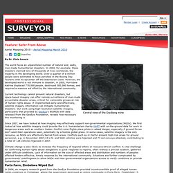
Chris Lavers The world faces an unparalleled number of natural and, sadly, man-made humanitarian disasters. In 2004, for example, these disasters claimed tens of thousands of lives worldwide, the majority in the developing world. CropScape - NASS CDL Program.