background preloader

Map

Facebook Twitter

OpenSource

Gps. Katie_Ct. Chris Harrison - Internet Map: City-to-City Connections. The Dimes Project provides several excellent data sets that describe the structure of the Internet. Using their most recent data at the time (Feb 2007 - email me for 2011 versions), I created a set of visualizations that display how cities across the globe are interconnected (by router configuration and not physical backbone). In total, there are 89,344 connections. The first rendering displays the relative densities of Internet connectivity across the globe.
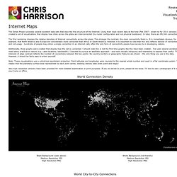
The stronger the contrast, the more connectivity there is. Additionally, three graphs were created that display how the net is connected. Note: These visualizations use a cylindrical equidistant projection. Very high resolution versions have been provided for more detailed examination or print purposes. World Connection Density World City-to-City Connections European City-to-City Connections North American City-to-City Connections. USGS Topographic Quadrangle Maps by County. iPod Subway maps. Google Maps - United Kingdom. Google Maps.