
Geocaching. Garmin60csx. Gps-osx. iHikeGPS for iPhone, iPod touch, and iPad on the iTunes App Store. Google Map directions converted to GPX file. Travel Bug Project. EasyGPS - FREE GPS Software for your Garmin, Magellan, or Lowrance GPS. GPSTagr: geotag flickr photos using GPS. Procrastination: Geotagging Photos. Now that I have a GPS, I can have some fun with hiking and photography.

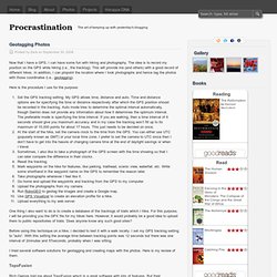
The idea is to record my position on the GPS while hiking (i.e., the tracklog). This will provide me (and others) with a good record of different hikes. In addition, I can pinpoint the location where I took photographs and hence tag the photos with those coordinates (i.e., geotagging). Here is the procedure I use for the purpose: Set the GPS tracklog setting. One thing I also want to do is to create a database of the tracklogs of trails which I hike. Before using this technique on a hike, I decided to test it with a walk locally. I tried several software solutions for geotagging and creating maps with the photos.
TopoFusion Rich Owings told me about TopoFusion which is a great software with lots of features. However, it does not output the coordinates of the photo locations in any form (EXIF data of the images or as waypoints in a GPX file). Here is my test of TopoFusion. GPSBabel - convert, upload, download data from GPS and Map programs. The Official OziExplorer Web Site - GPS Mapping Software for Magellan, Garmin, Lowrance, Eagle, MLR Receivers. GPS Software Homepage. ExpertGPS - GPS Mapping Software for Windows. TopoFusion.com = GPS Mapping Software for Windows. JDMCOX Software. Book on How to make you own maps and load them onto your GPS receiver. Garmin International. GPSMAP 60CSx. Fun with GPS. Main Page - OpenStreetMap.
Verizon Wireless Launches VZ Navigator Service. Verizon Wireless, the nation’s premier provider of wireless products and services, announced today the availability of VZ NavigatorTM – a new tool for customers that gives them access to a wide array of Location Based Services (LBS) options, including mapping, audible turn-by-turn navigation and the ability to find over 14 million points of interest.

We reported on this in December, now Verizon is getting around to launching the service. Initially available on the new Motorola V325, VZ Navigator is perfect for road warriors who are constantly on-the-go, allowing them to see a map of their current location or an address in the U.S., locate places such as restaurants, gas stations, banks and other points-of-interest relative to their location, plus hear turn-by-turn navigation with audible voice directions to an address in the U.S.
VZ Navigator will help Verizon Wireless customers get to where they are going, easily and efficiently. ReadMore Read More in: GPS News Related Articles: International - Press Release. Corporate January 10, 2006 Garmin Announces GPS Product Support for Mac OS X MACWORLD EXPO, SAN FRANCISCO/January 10, 2006/PR Newswire — Garmin International Inc., a unit of Garmin Ltd.

(Nasdaq: GRMN), today announced that it will immediately begin to make its line of GPS and mobile electronics devices compatible with Mac OS X version 10.4 "Tiger. " This makes Garmin the first major GPS designer and manufacturer to announce direct support for Mac OS X. “We are very excited to be supporting the many tech-savvy Garmin users who are also Mac devotees,” said Min Kao, Garmin Ltd.’s chairman and CEO.
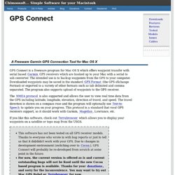
"The popularity of Mac OS X is attracting many first time developers to the Mac and driving astonishing innovation," said Ron Okamoto, Apple’s vice president of Worldwide Developer Relations. Beginning in spring 2006, Garmin will offer a Mac version of its popular Training Center software. Also in spring 2006, Garmin will make the www.MotionBased.com upload interface Mac compatible. GPS Connect for Mac OS X. A Freeware Garmin GPS Connection Tool for Mac OS X GPS Connect is a freeware program for Mac OS X which offers waypoint transfer with serial based Garmin GPS receivers which are hooked up to your Mac with a serial to usb converter.

The intended use is to backup waypoints from the GPS to your computer. Downloaded waypoints may be saved in the standard GPX Format (the GPS eXchange Format) or exported to a variety of other formats such as tab delimited and comma separated. The program also supports upload of waypoints to the GPS receiver. The NMEA protocol is also supported and allows the user to view real time data from the GPS including latitude, longitude, elevation, direction of travel, and speed.
GPS Integration for Mac OS X.