
Interactive Earth: Creating Hybrid Spatial Solutions: Commercial and Open Source. Open source geospatial systems and tools have really taken off in recent years, as has the open source community at large.
While an open source geospatial solution may be enticing to some GIS managers, there remain a number of hurdles for them to be effectively employed. Chief among these hurdles are the lack of documentation, training, and the added difficulties of configuring or extending open source solutions (it’s tough to get a good ArcSDE administrator, it’s tougher still to get a good PostGIS administrator). Interactive Earth: Customizing the Google Earth Interface. Ever since people became aware that it was possible to allow external software applications to interact with Google Earth using their API (which seems to be in perpetual beta stage), they have been trying to figure out how best to integrate their custom applications into Google Earth.
While almost all of the initial efforts dealt with taking existing applications and simply loading their data into GE in a KML format, later efforts involved trying to make all functionality directly accessible form the Google Earth application itself. The basic problem, however, is that Google Earth does not provide a framework to extend its user interface. You cannot simply add a new button to their toolbar that fires off your own application, as you can in many GIS and Office software packages. Interactive Earth: Embed Google Earth Into Your Application. This method for customizing the Google Earth Interface, embedding the Google Earth render window (the actual map window) into your own applications, was apparently pioneered Luca Rocchi and his Google Earth Airlines application.
Luca figured out that you could grab the GE map window using its Windows handle to place it into your own application. He has used this to plop GE into web applications, but the ActiveX control that he provides for free can also be used in any COM compliant language (such as VB.Net or C#). Interactive Earth: Create Your Own Google Earth Application.
Building an application to work with Google Earth is pretty easy to do.
This article will walk through the creation of a very simple application to capture different views in Google Earth. To begin with, you will need to download Microsoft's Visual Studion Express Edition for C# (available for free at Once Visual Studio is installed, select 'New Project' from the 'File' menu. In the New Project dialog box, select 'Windows Forms Application' and name your application 'FirstGeApp' (see below). Then select OK. Once the new form is visible, right click on it and select 'Properties'. Name = frmViewCapture Text = View Capture. Terrain Tools & Software - Commercial. CitySurf - Server Based 3D GIS " (CitySurf - Sunucu Tabanlı 3B CBS) 3D Route Builder - Hybrid GeoTools. 3D Route Builder for Google Earth 3D Route Builder is a powerful GPS editor for fine grain control over paths directly in Google Earth.
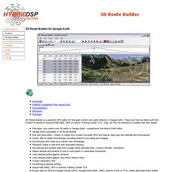
These can then be either built from scratch or based on existing KML/KMZ, GPX or Garmin Training Center TCX. They can then be retraced at scalable real time speed. Earth Outreach. Google Earth makes it easy to create a map with annotations - you can add placemarks (points), paths (lines), polygons in Google Earth, and add text, images, and videos to the pop-up balloons.
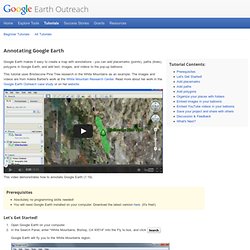
This tutorial uses Bristlecone Pine Tree research in the White Mountains as an example. The images and videos are from Adelia Barber's work at the White Mountain Research Center. Read more about her work in the Google Earth Outreach case study or on her website. This video demonstrates how to annotate Google Earth (1:19). Prerequisites Absolutely no programming skills needed! Let's Get Started! Convincing Construction Visualization. Geoverse MDM. The complexity of handling the datasets generated by 3D laser scanning and photogrammetry has now been made simple.
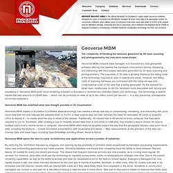
Geoverse MDM (massive data manager) is a revolutionary new geospatial software offering that slashes the hardware costs behind storing, displaying, and interacting with the complex data sets generated by 3D laser scanning and photogrammetry. The popularity of 3D data is growing thanks to the falling costs of the technology required to scan in objects and areas. However, the falling costs of scanning hardware are contrasted with the rising storage and computational costs of the data that is being generated. As the demand for detail rises, traditionally, so did the hardware costs associated with storing and visualising it. Geoverse MDM point cloud rendering is based on Euclideon’s revolutionary Unlimited Detail (UD) technology. Geoverse MDM has redefined what was thought possible in 3D visualisation.
Glob3, a 3D GIS framework. Ark Platforms Inc. Ark Platforms. Animating Google Earth (3D) & Map (2D) for Live GPS via Ajax and RestFul Web Service. Download demo project - 10.28 KB Introduction I work for a company 'Momentum Technologies' in Australia which provides real time video streaming solutions.
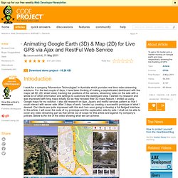
For the last couple of days, I have been thinking of making a sophisticated dashboard with live maps (all 3D, 2D, street view), tracking live positions of the camera, streaming video on the side with a whole lot of other information and settings to customize the dashboard view. I started my research and was impressed with bing maps initially but as they revoked their 3D maps feature, I ended up using Google maps for my solution. I also did research on Ajax, Jquery and restful services pattern so that I could interact with server side. Click here to watch the demo video. I am a regular lazy viewer of CodeProject and this is my first article to share the working behind my prototype. Summary The prototype is quite simple and there is no complex logic involved in it. Google Maps API Tutorial. Google Maps API Tutorial This tutorial is intended to help you create your own interactive maps using the Google API.
Do take a look at the Google documentation. MicroStation’s Google Earth Tools Integration. Remote GeoSystems - Remote GeoSystems - Geospatial Video & Photo Mapping. Geospatial video mapping with Google Earth. By SPAR Point Group staff | January 09, 2014 Remote GeoSystems, Inc. has released geospatial video mapping software using Google Earth as a base map for aerial and mobile inspections and monitoring.
Called LineVision Google Earth, the application is a video viewer that allows users to geospatially “navigate” a video recording by clicking a location along the aerial or terrestrial GPS track positioned in Google Earth to spatially “forward” or “reverse” the video to that exact location. The video then automatically advances to that point in the video so analysts and subject matter experts can visually interpret what was recorded at that specific place and time. As the video plays, a cursor moves along the GPS track, constantly indicating where the current view was recorded, the company said. If something of interest is detected, video users may snap a still image that is geotagged and saved for future analysis. Animating Google Earth (3D) & Map (2D) for Live GPS via Ajax and RestFul Web Service. Goodfellow Air Force Base integrates SOCET GXP Video Analysis capabilities into its training and simulation program.
Gil Gonzalez One tool – realistic and relevant training! Submitted by Gil GonzalezApplications engineer The 17th Training Wing, located at Goodfellow Air Force Base, Texas, harnesses the power of modeling and simulation to train intelligence warfighters. Goodfellow’s 315th Training Squadron develops new initiatives to keep the schoolhouse program relevant using the latest simulation technology, intelligence systems, and applications. The motion imagery curriculum is part of the Air Force Geospatial-Intelligence Analysis course that integrates SOCET GXP’s Video Analysis application with Air Force Synthetic Environment for Reconnaissance and Surveillance (AFSERS) capabilities.
MicroStation’s Google Earth Tools Integration. Georeferencing on a Budget: Using iPhone and Freeware Apps to Geotag a Mountain of Image Files. Summary: As flood waters rose on the Missouri River in July 2011, emergency management officials needed to quickly access images for monitoring flood stages and for search and recovery. But how to do it fast and on a miniscule budget? Jeff Herzer, a GIS graduate student and former assistant chief telecom engineer at Missouri State Highway Patrol, gives us his method for geotagging photographs and assigning lat-long coordinates to each image … all for $5.00!
Editor's Note: See the many graphics accompanying this article at the bottom of the text portion. In June and July of 2011, the Missouri River reached levels last seen during the great flood of 1993.