
Home - GeoInteractive.
NAVVIS – Indoor Positioning and Mapping. AniMove - Animal Movements: A collaborative project — Faunalia - free and open source GIS. The analysis of animal movement and ranging behaviour (including the estimation of home range size) is a complex issue.
A number of programs have been written (see this web site for an obsolete and incomplete list), but all suffer from one or several limitations, including: limited customizability (for ad hoc analyses, change of calculation methods, etc.)undocumented calculation methods (crucial especially for kernel analyses)limited or no interaction with Geographic Information Systems (GIS)the need to purchase proprietary, expensive software We believe the problem could be solved by the use of several free and open source programs, available both for GNU/Linux, Mac OSX and MS Windows operating systems.
We aim at producing the most advanced software; our indicative term of reference is Animal Movements (which requires the expensive, obsolete, and proprietary ArcView + Spatial Analyst proprietary packages). Developing python plugins for QGIS is easy, cheap, and fast. Markaeology: How to create a Digital Elevation Model from Photosynth point clouds. Recent developments in the Open Source community have made it easier to create 3D models from point cloud data derived from Structure from Motion (SfM) technologies such as Photosynth and Bundler.
This article outlines the steps I use to create Digital Elevation Models (DEM) from data acquired from kite, blimp, and UAV aerial photography. In order to standardize this tutorial, I've created a set of data that you can follow along with using a Windows based computer. All of the concepts described here should also work in a Linux environment with little modification. Useable examples of all the files created during this tutorial are available for download at www.palentier.com/DEM_Tutorial . I have attempted to use as many free and open source applications as possible but the final steps are completed in the commercial ArcGIS software.
The software needed for this tutorial are: Dr Matt Nolan. 01 January 2014 Santa got me a UAV for Christmas.
I've long been skeptical of whether there is anything they can do that can't be done better and cheaper from a manned aircraft, when the true costs and hassles are factored in. But given advertiser claims of how easy the small ones are to use and how cheap they are, I figured I had little to lose in checking one out. I wanted the minimum of hassle and maximum of fun and science, so I chose the DJI Phantom 2 Vision, which comes ready to fly and has a built-in camera.
GEL Data Solutions - MAP. Vehicle tracking. Mapping the world. 3D MapView. The myVR 3D MapView client allows you to integrate powerful real time photorealistic 3D Map viewing technology directly with your existing online 2D map services in any Internet Browser.
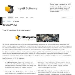
Using myVR Software's patented distribution and real time 3D viewing technology you can now easily add viewing of large scale 3D city models to your web site or service. Furthermore, these very large 3D city models can then be easily integrated with existing 2D aerial/orthophoto imagery that combined with elevation data allows us to automatically generate highly accurate 3D maps. The 3D MapView client is available as a highly optimized and lightweight ActiveX Control / NPAPI plug-in and supports a wide variety of Internet Browsers. From a integration/development viewpoint the viewing client is fully configurable/customizable though XML and Javascript. All integration aspects such as UI branding/controls, navigation, camera views, overlay support and more is easily changable. Sample Videos. Publish, share and embed interactive 3D models.
Welcome - GeoServer. Georef PDF. Google earth visualisation. 3dPDF. With $30M in Tank, UAV Maker 3D Robotics Gets Ready for Take-Off. Bruce V.
Bigelow10/3/13 (Page 2 of 3) nearly 44,000 members today, Anderson says. 3D Topographic Map Table by Applied Minds. April 16th, 2007 in Machines, Tangible, Touch by miles Applied Minds has developed a touch table that displays information in a three dimensional way.
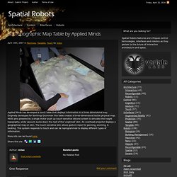
Originally developed for Northrop Grummen this table creates a three-dimensional tactile physical map. 4600 pins powered by a single motor push up touch-sensitive silicone screen to simulate the height topography, while vacuum sucks down the rest of the ‘unpinned’ skin. An overhead projector displays a geographical map on skin. The touch-sensitive skin allows gesture input for panning, zooming, & locating. This system responds to touch and can be reprogrammed to display different types of information. More info can be found here. 3D Mapping & 3D Modeling Market worth $7.7 Billion by 2018.
DALLAS, March 13, 2013 /PRNewswire/ -- According to a new market research report "3D Mapping Market: Global Advancements, Business Models, Technology Roadmap, Forecasts and Analysis (2013 - 2018)", the 3D mapping and 3D modeling market is expected to reach $7.7 billion by 2018 at a CAGR of 47.9% from 2013 to 2018.
Browse.
Geospatial Modeling & Visualization. Advice from Geospatial Startups. Summary:
Ecosynth - 3D Tools for Ecology. A Method Store for Advanced Survey and Modeling Technologies. Published Resources 1) Abramov, Alexey et al. “Depth-supported Real-time Video Segmentation with the Kinect.” Proceedings of the 2012 IEEE Workshop on the Applications of Computer Vision. Washington, DC, USA: IEEE Computer Society, 2012. 457–464. Web. 6 July 2012. 2) Bleiweiss, Amit et al. 3) Borenstein, Greg. 4) Boulos, Maged N Kamel et al. 5) Burba, Nathan et al.