
Arctic environment. Race to sail Northwest Passage heats up. Cruise ship Crystal Serenity's planned 2016 voyage through the Northwest Passage is a sign of ever-increasing appetite for Arctic travel.
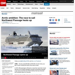
Years of planning have gone into this Northwest Passage trip. "To do this with a ship like ours, we couldn't just do this like a normal cruise," says Thomas Mazloum of Crystal Cruises. "It really is an expedition. " The boat will start in Anchorage, Alaska and end up in New York. Shell Didn't Quit Alaska Out of the Goodness of Its Heart. In the history of Arctic expeditions, tenacity in the face of certain failure is a common theme.
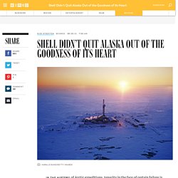
Almost as common is actual failure. What you don’t see a lot are epic explorers—your Hensons, your Parrys, your Amundsens—packing up and going home. Not that Royal Dutch Shell—giving up on Alaskan offshore drilling after nine years, $7 billion, and one shipwrecked drilling platform—has anything to be ashamed of. Petroleum exploration in the Arctic. Location of Arctic Basins assessed by the USGS.
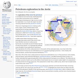
The exploration of the Arctic for petroleum is considered more technically challenging than in any other environment so far. However, technological development, high oil prices allow for exploration. La course aux ressources et aux territoires en Arctique. No More Arctic Drilling Attempts For Shell. The Arctic drilling season has come to an end, and with it, Shell’s hopes of striking oil in the Chukchi Sea.

Royal Dutch Shell announced Monday it would stop oil exploration in the environmentally sensitive region, 140 miles off Alaska, for the “foreseeable future.” The company received permits from the Obama Administration this year to conduct exploratory drilling, despite massive protests from environmentalists. The exploration has been unsuccessful, the company said. “Shell continues to see important exploration potential in the basin, and the area is likely to ultimately be of strategic importance to Alaska and the US,” Marvin Odum, director of Shell Upstream Americas, said in a statement. Atlas of the Cryosphere: OGC Services (WMS, WFS, WCS)
Open Geospatial Consortium (OGC) Services Interoperable and customizable data access to Atlas of the Cryosphere maps and source data are enabled via the following OGC specifications: Using these services, maps and source data can be accessed remotely for your spatial region and layers of interest either directly through a URL string (more on this below) or through the various OGC-compatible clients available for accessing these services, such as Gaia 3, MapServer, ArcGIS 9 Service Pack 2, ENVI Zoom 4.3.1, Google Earth 4, NASA World Wind, Quantum GIS (QGIS), GRASS, and uDig, to name just a few.
Table of Contents: GetCapabilities Request Remote access through an OGC-compatible client is normally obtained via an OGC GetCapabilities request as in the following examples for the Northern and Southern Hemispheres of the Atlas, where the service parameter can be either WMS, WFS, or WCS. Here are some examples of how to construct a GetMap request using the above parameters. GetLegendGraphic: MASIE Home Page. Maps - Arctic Council. A large number of Arctic Council research and assessment projects result in production of maps of the Arctic.
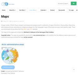
Among others, these show administrative division and where the indigenous peoples live, their languages, maps of the ocean and many, more specific maps. These can be accessed among others from the AMAP and CAFF websites. The maps on this page were compiled by Winfried K. Dallmann of the Norwegian Polar Institute. Copyright notice: The maps are available for download for non-commercial use on the condition that the reference made to persons and institutions that have compiled the maps not be removed.
ARCTIS Database (Arctic Resources and Transportation Information System) Northern Sea Route Information Office. Marine transportation on the Northern Sea Route is regulated by the legislation based on the principles of the UN Convention on the Law of the Sea, 1982, in particular article 234 “Ice-covered Areas”.
This article authorizes the coastal states within the exclusive economic zone to adopt and enforce the non-discriminatory laws and regulations for prevention and monitoring of marine pollution from vessels in the areas covered with ice for most of the year. In summer 2012 Russian Federation adopted New Federal Low on Amendments to specific legislative acts of the Russian Federation related to Governmental regulation of merchant shipping in the water area of the Nothern Sea Route. Based on Federal Low in January 2013 Ministry of Transport of Russian Federation developed and approved New Rules of Navigation in the Northern Sea Route water area. Natural Resources and Sustainable Development. As Arctic waters open up in the summer and glaciers recede, there will likely be more exploration of unexploited petroleum, gas and mining in the region and more cargo transiting northern waterways.
The Northern Sea Route along the Russian coast is now partly open. Analysts predict trade between Europe and Japan, China and South Korea will expand by using these shorter routes. La Chine à la conquête des ressources minières du Canada et de l’Arctique canadien ? Géographie de l’approvisionnement chinois dans le secteur du fer et de l’acier. Arctic Deeply, Focused Coverage of the High North. NSIDC Scientific Data Search. … et l'Arctique deviendra un océan.
ABDS - Homepage - Arctic Biodiversity Data Service (ABDS) Arctic Maps.