
PyQGIS: des géométries, des vecteurs, de l'algèbre vectorielle ou des cosinus directeurs, exemples d'applications. Après avoir présenté les algorithmes et les fonctions en Python dans la première partie, PyQGIS: des géométries, des vecteurs, de l'algèbre vectorielle ou des cosinus directeurs..., nous allons en appliquer certains pour illustrer quelques applications sur un plan 2D avec PyQGIS à partir des diverses questions/réponses fournies par moi et d'autres sur le ForumSIG et sur gis stackexchange: Visualisation dans QGIS Avant de commencer, il est nécessaire de pouvoir visualiser ces vecteurs/géométries dans QGIS de manière simple à partir de la console Python.
Cela se fait en utilisant la particularité des « memory layers » (couches virtuelles, en mémoire). crea_mem_layer.py #! Ce qui permet, en plaçant ce script dans le path de Python (PYTHONPATH): Résultats dans QGIS: Nous voici armés pour appliquer les algorithmes et fonctions de géométrie vectorielle analysés dans le précédent article et résumés dans le script algèbre_vect_PyQGIS.py. Exemples d'applications Résultat: COGO - Coordinate Geometry software for Land Surveyors - ProCogo. ProCogo provides you with quick, straightforward coordinate geometry for your land surveying or civil engineering business without all the hassle and expense of big CAD based systems.

Instead of waiting for your big CAD/Survey COGO system to load just to get a quick point list or stakeout sheet, ProCogo's clean intuitive user interface lets you do the COGO calculations you need and the get the printouts you want in record time. In addition, ProCogo can work with other land surveying software such as TIN Master and our Legal-Aid - legal description writer to give you contouring and legal description capabilities.
More Affordable Than Ever! Now sold on a yearly subscription basis, you pay only $295 to enroll and $139 annually from the second year. Subscription includes one year of use, updates, service packs and operating system changes as they become available. Paper.js — global. Vector Geometry. Vector geometry is a first class citizen in Scriptographer.
It is a great advantage to understand its basic principles when learning to write scripts for it. After all, there is a reason why the word Vector is used to describe Illustrator's drawing techniques as Vector Graphics. While building Scriptographer we found vector geometry to be a powerful way of working with positions, movement and paths. Once understood, it proves to be a lot more intuitive and flexible than working with the x- and y- values of the coordinate system directly, as most other visually oriented programming environments do.
COGO - Coordinate Geometry software for Land Surveyors - ProCogo. ProCogo provides you with quick, straightforward coordinate geometry for your land surveying or civil engineering business without all the hassle and expense of big CAD based systems.
Instead of waiting for your big CAD/Survey COGO system to load just to get a quick point list or stakeout sheet, ProCogo's clean intuitive user interface lets you do the COGO calculations you need and the get the printouts you want in record time. In addition, ProCogo can work with other land surveying software such as TIN Master and our Legal-Aid - legal description writer to give you contouring and legal description capabilities. More Affordable Than Ever! Now sold on a yearly subscription basis, you pay only $295 to enroll and $139 annually from the second year. Subscription includes one year of use, updates, service packs and operating system changes as they become available. Traverse PC Land Surveying Software. Traverse PC Land Surveying Software. LandXMLLot SetbacksAutoUpdateSurvey Point PropertiesOtherAgile ReleasesUpdate v13/14Update v1-11.6Update PolicyUpgrade Policy LandXML TPC Professional Edition now supports LandXML (version 1.2).
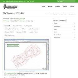
You can exchange data with many other applications with XML files. Why LandXML Now? Many of our users have asked us to support LandXML as a way to communicate with the engineering world. What is LandXML? LandXML is a data exchange format developed by the LandXML organization (www.landxml.org). LandXML files provide a common denominator for software programs like Traverse PC to share surveying and engineering data. Version 1.2 LandXML has been in version 1.2 for a long time (since 2006). Importing LandXML Video When you select a LandXML file to import, TPC lists all the data in a familiar Tree structure. Once imported, TPC organizes parcels and alignments into their respective Traverse Groups, puts surfaces in the Surfaces Manager, points in the Points Manager and so on. Detailed description of what QuickCogo does. Www.equalparenting-bc.ca/abba/adobe-pdfs/1994-xx-xx_HP48-COGO-Manual.pdf. Free COGO Software - Evaluation and Feedback - Land Surveyors United.
Legal Description Writer for Civil 3D, AutoCAD and Land Desktop. Write legal descriptions in seconds right from within AutoCAD®, AutoCAD Civil 3D, or Land Development Desktop with Legal-Aid.
This legal description writer automatically creates legal descriptions from geometry in your AutoCAD based drawings giving you a complete, accurate dimensional legal description of the parcel. AutoCAD Civil 3D parcels are also supported by Legal-Aid. Review, edit and spell-check the legal description with the built-in word processor. Oh, and did we mention that all phrases are highly customizable, so you can create legal descriptions that reflect your style, not ours! (Legal-Aid 2007 and above) Legal-Aid versions available for AutoCAD R14.01 through AutoCAD 2014 And now also for General CADD Pro 5, 6, & 7.
COGO - Coordinate Geometry software for Land Surveyors - ProCogo. Underhill Geomatics Ltd. Q-Cogo: Online Land Surveyor's Calculator. Carlson Software - Survey. Carlson Survey Carlson Survey gives users upgrades to core features like the coordinate database, Field-to-Finish coding and cut sheets, as well as new commands, including one to twist points to a 3D view, among its many additional improvements.
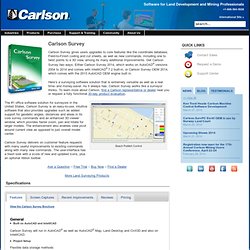
Get Carlson Survey two ways: Either Carlson Survey 2014, which works on AutoCAD® versions 2004 to 2014 and comes with IntelliCAD® 7.2 built-in, or Carlson Survey OEM 2014, which comes with the 2013 AutoCAD OEM engine built in. Here’s a surveying software solution that is extremely versatile as well as a real time- and money-saver. As it always has, Carlson Survey works like a surveyor thinks. To learn more about Carlson, find a Carlson representative or dealer near you or request a fully functional 30-day product evaluation. Seach Publish Control Carlson Survey delivers on customer feature requests with many useful improvements to existing commands along with many new commands. COGO Software Debate. Carlson Survey - COGO. Aide.