11 incredible wilderness photographs from the 1800s. Early American wilderness photographers were snapping gorgeous vignettes of mountain peaks and sunrises before Instagram's "1977" filter was even a thing. But, aside from their timeless appeal, the true value of these nineteenth-century photographs is derived from their role in the American conservation movement. Since the 1860s, photography has played an important but little-known part in the field of nature conservation. A handful of pioneering artists intentionally used their photographs to promote conservation and instill in viewers a tangible connection to America's last wild places. Embedded in these images is a deep empathy for the natural world and the power to bring about positive change. "A photograph is one that fully expresses what one feels, in the deepest sense, about what is being photographed.
" - Ansel Adams Perhaps the most renowned conservation photographers are Ansel Adams (1902-1984), Carleton Watkins (1829-1916) and William Henry Jackson (1843-1942). See also: Calisphere - California Cultures. Teach with Selected California Cultures Images Use these lesson plans just as they are, or as springboards for your own creative ideas. Los Californios: California's Spanish, Native American, and African Heritage Children in the Fields: The Life of the Hispanic Child Laborer During California's Agriculture Explosion "How Do Men Like You Become Great? ": The Early Years of Dr. Ralph J. Bunche Stealing Home: How Race Relations, Politics, and Baseball Transformed Chavez Ravine The Prints of Self Help Graphics: The Chicano Movement in California — Culture, Causes, and Community. Photos: When L.A.'s Most Famous Streets Were Dirt Roads | LA as Subject | SoCal Focus. Sunset Boulevard at Gower in 1907.
Courtesy of the Photo Collection - Los Angeles Public Library. More from L.A. as Subject Like some of the very people who drive on them, a few Los Angeles streets have achieved the height of fame. Sunset Boulevard lent its evocative name to Billy Wilder's classic film noir. But fame belies the humble origins of these celebrity streets. Even in dense downtown Los Angeles, street conditions brought complaints to Angelenos' lips. Macadam paving, followed by concrete and asphalt surfaces, eventually helped Los Angeles' roads shake their rustic character.
Note: Despite the title, not all the photos here necessarily depict unpaved roads. Sunset Boulevard Sunset Boulevard in Hollywood, ca.1905. Sunset Boulevard at Normandie, ca. 1900. Hollywood Boulevard Hollywood Boulevard at its intersection with Sunset in 1904. Hollywood Boulevard at Grand in 1907. Wilshire Boulevard A 1912 view of Wilshire Boulevard, then named Nevada Avenue, in Santa Monica. California Before the Stars Arrived. A.
R. Williams An extraordinary archive of 4,600 photographs taken in the city of Los Angeles and the beach suburb of Santa Monica between the 1870s and the 1950s has recently been acquired by the Huntington Library in San Marino, California. Many of the photographs show streets and buildings that were important to the history of the area. Others were made for the tourist trade. "Some of these images I'd only seen in bad reproductions," Jennifer Watts, Huntington's curator of photographs, said in a phone interview. "Now we have the original prints. The previous owner was a local resident, 89-year-old Ernest Marquez. "He has a very good eye," says Watts. The earliest photos show the dramatic changes that came to southern California in the late 1800s.
When it opened in March 1887, the 125-room Arcadia Hotel (above) was the finest place to stay in Santa Monica. An early version of a roller coaster connected the cliffside building with the burgeoning town. Seaside Resort Beer and Banquets. The Lost Wetlands of Los Angeles | LA as Subject | SoCal Focus. A man wades into Ballona Lagoon, circa 1902. Courtesy of the Title Insurance and Trust / C.C. Pierce Photography Collection, USC Libraries. What did the L.A. Basin look like before there was a Los Angeles? A common misconception—one that resonates with genuine concerns about the city's aridity and reliance on imported water—is that the city's natural state is desert. But early accounts of the landscape painted a different picture, depicting a patchwork of grassy prairie, wetland, scrub, oak woodland, and dense willow thickets where freeways, office towers, and houses stand today.
Recently, a team of scientists, geographers, and other researchers released a report for the Southern California Coastal Water Research Project that reconstructs the historical landscape of the Ballona Creek watershed—a 130-square-mile swath of land home to more than 1.2 million people that includes much of western Los Angeles, Beverly Hills, Inglewood, South Los Angeles, and the Baldwin Hills. Calisphere - California Cultures - Hispanic Americans: Spanish Colonization and Californios (1769-1800s) Questions to Consider How does the map of Alta California (in the map of the United States of Mexico) differ from what California looks like today? How did paintings of "pastoral fantasy scenes" differ from the realities of life in early California? Overview California was on the fringes of the Spanish empire until 1769, when a "sacred expedition" led by Captain Gaspar de Portolá and Franciscan Father Junípero Serra established outposts at San Diego and Monterey (Mission San Diego de Alcala and San Antonio de Pauda Mission are shown here).
Spanish Colonization and Missions (1769-1800s) The mission system was Spain's centuries-old method of advancing and securing its colonial frontiers by Christianizing and Hispanicizing native peoples. In their 60 years of operation, the 21 California missions had employed 142 priests and baptized 87,787 natives. For Spaniards, however, the California frontier was a place where castas (people of mixed ancestry) could move up the racial hierarchy. Grade 4: Becoming L.A.-The 1800s. History of the Los Angeles Flower District. Click here to download the Bloomin' News story about our Flower District (published May 2009) Two large wholesale flower markets and several storefront tenants comprise the core of the original Los Angeles Flower District, America's largest wholesale flower district.
(The District does not include the smaller flower malls on San Pedro and Eighth streets.) The Flower District's history dates back to the early 1900s. History: Flowers to America from The Colorful Land of California The incredible climate of Southern CaliforniaIn the 1800s, expansive open areas along the Southern California coast and around Los Angeles enjoyed the natural color and beauty of native grasses and wild flowers. The Los Angeles Coastal Prairie, a large coastal area near the El Segundo dunes, featured vernal pools and marshes and was carpeted with spectacular displays of wildflowers. Photo, right: Florists await the ringing of the 6:30 a.m. What changed? Remember to order your copies of: Los Angeles. 1st and Broadway looking South, 1860 Looking South on Poundcake Hill, 1868 View looking East from Justicia on Fort Moore Hill, 1869 Looking North from 11th Street and Main Street, 1873 View looking West on Temple Street, 1874 Looking South West on Main Street, 1874 Looking South West on Spring Street from Temple Block, 1876 Looking South East from Court Street between Broadway and Hill Street, 1876 Looking South East down 3rd Street across Hill Street, 1876 3rd Street looking West from Hope, 1880 View Looking West on Temple Street, 1882 Hill Street between 2nd and 3rd looking South, 1885 Looking South across 2nd Street on Grand Avenue, 1886 2nd and Hill looking East, 1894 1st and Broadway looking NW, 1886 Sources: USC Digital Archive via G.S.
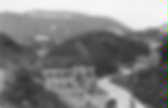
1800s – Hidden Los Angeles. Welcome to the original 101 Freeway. Photograph of two cyclists on the Cahuenga Pass, Los Angeles, circa 1897. The man to the right walks his bicycle on the unpaved road, looking at his companion riding to the left, on whose back is strapped a briefcase of some kind. The terrain surrounding them is comprised entirely of grassy hills. Caption on photoprint reads: “Cahuenga Pass — connecting Hollywood and San Fernando Valley — as it was in 1897.” Click on image for larger view. Los Angeles County-Government-About LA County. History History of County Communities The area comprising present-day Los Angeles County was first settled by small groups of Native Americans for centuries before the first European contact in 1769 when Gaspar de Portola and a group of missionaries camped on what is now the banks of the Los Angeles River.
In September 1771, Father Junipero Serra and a group of Spaniards founded the San Gabriel Mission as the center of the first “community” in an area inhabited by small bands of Gabrielino Indians. Ten years later the Pobladores, a group of 11 families recruited from Mexico by Capt. Rivera y Moncada, traveled from the San Gabriel Mission to a spot selected by Alta California Gov. Felipe de Neve to establish a new pueblo. The settlement was named El Pueblo de la Reyna de Los Angeles (The Pueblo of the Queen of the Angels). In September 1797, the Franciscan monks established the San Fernando Mission Rey de Espana in the northern San Fernando Valley.
Gold Rush and Growth Incorporation. LA History Gallery. [This picture gallery was updated on 5 August 2001] Picture Gallery of Los Angeles History Contents Downtown Los Angeles, Back ThenSite of the Original Pueblo (1781early 1800s)Around and About the PlazaSources Downtown Los Angeles, Back Then Fifty Years Ago: Downtown Los Angeles Before the Freeways.
Ninety Years Ago: Downtown Los Angeles Before the Civic Center. One Hundred and Thirty Years Ago: Downtown Los Angeles Before the Railroad. Site of the Original Pueblo (1781early 1800s) Map of the original pueblo of Los Angeles, founded on September 4th, 1781 and confirmed on September 4th, 1786. Plat of the original pueblo showing homesites and other buildings. Looking Northwest. Looking East. Looking North. Looking Northeast. Around and About the Plaza Sketch of the Plaza in 1847. Sketch of the Area South of the Plaza in 1847. The Plaza in 1869. The Plaza in 1869. 1873 Ruxton Survey of the Central Pueblo. The plat was drawn by the author. Map of Historic Sites in and near the Plaza Area. Downtown los angeles and bunker hill in the 1800's - a set on Flickr. Water and Power Associates.
Map of Los Angeles as it appeared April 4, 1850 based on the 1849 Ord Survey: (Note: The Abel Stearns adobe is indicated by the number 9 on the map) Before and After For more Historical Los Angeles Views click one of the following: For Other Historical Views click one of the following: See Our Newest Sections: To see how Water and Electricity shaped the history of Los Angeles click one of the following: Water: Power: References and Credits **DWP - LA Public Library Image Archive * LA Public Library Image Archive *^LADWP Historic Archive *# Mojave Desert.net: Remi Nadeau #* Ancestory.com - Margarita Bandini Winston #^ Huntington Digital Library Archive ^# KCET - The Lost Hills of Downtown Los Angeles #**OUTPOST – Preserving Historical Data by W. #^*Early Downtown LA - Hollenbeck Hotel #^^theeastsiderla.com: Boyle Hotel #*^LA Conservancy: Boyle Hotel ^^*USC Image Archive **^Los Angeles Fire Department Historical Archive; Belmont Hotel Fire ^^#The Museum of the San Fernando Valley ^*^LA Street Names - LA Time.
Los Angeles County - 1887 to 1909. HEADLINE HISTORY Los Angeles County 1887 to 1909 Orange County is formed from a portion of Los Angeles County. The city of Pomona is incorporated. A great speculative land boom occurs, driving up the price of city land 500 percent. Whittier is settled by a group of Quakers. Burbank and Glendale are incorporated. The first public high school in Los Angeles opens. Pomona College is founded in Claremont. Heavy floods occur. Heavy floods occur. Heavy floods occur.
Heavy floods occur. Edward Doheny makes the first oil discovery within the City of Los Angeles. Four Los Angeles banks close due to nationwide economic problems. During the nationwide railroad strike, labor rioting breaks out in Los Angeles. A heavily traveled Los Angeles thoroughfare is given the name Wilshire Boulevard. Congress appropriates $3.9 million to build an artificial harbor at San Pedro. The first known automobile to appear on Los Angeles streets arrives, built by S.D. The Los Angeles Stock Exchange is established. Water and Power Associates. Before and After Beverly Hills (Before and After) Before and After For more Historical Los Angeles Views click one of the following: For Other Historical Views click one of the following: See Our Newest Sections: To see how Water and Electricity shaped the history of Los Angeles click one of the following: Water: Power: References and Credits * DWP - LA Public Library Image Archive ^ LA Public Library Image Archive **LADWP Historic Archive ^^USC Digital Archive ^*The Valley Observed: Street Name Origins; Timeline of Valley History *# blogdowntown: Third Street Tunnel #* About.Com: History of Electric Vehicles #^Flickr.com: Michael Ryerson #**California Historical Society Digital Archive #^^Calisphere Digital Archive #^*San Fernando Valley Relics - valleyrelics.com: Universal Studios Tour Opening Day #*^Library of Congress: Venice Lagoon *##LA Times: Dig Into History You'll Find Snake Oil; Historic Bridge to Downtown Reopens; Building the LA Aqueduct; 1900 Fashion ^#*City of Redondo Beach HIstory ^#^#U.S.