U.S. State Capitals. If It Were My Home. GeoBee Challenge Game, Geographic Bee Practice, Geography Trivia. NatGeo Mapmaker Interactive. Gallery Interactives: Fossils. Journey to the Centre of the Earth. In Pieces - 30 Endangered Species, 30 Pieces. MapAList - Create and Manage Maps of Address Lists. Cost of Living. Kinetic City: landform creation game. Earth - Your life on earth. Explore BBC Earth's unique interactive, personalised just to you.
Find out how, since the date of your birth, your life has progressed; including how many times your heart has beaten, and how far you have travelled through space. Investigate how the world around you has changed since you've been alive; from the amount the sea has risen, and the tectonic plates have moved, to the number of earthquakes and volcanoes that have erupted. Create and share your maps.
Everest: Rivers of Ice. NASA's Climate Kids. Antarctic Food Web Game. Ecosystems are composed of living things and the physical environment with which they interact.

Different species within an ecosystem have different functions that help cycle energy from the Sun—the source of nearly all energy that is critical to life on Earth—through it. Some species are producers, which convert sunlight into chemical energy through photosynthesis. Others are consumers, which feed on producers (and other consumers). These species can be further organized into groups or levels called trophic levels. Organisms at higher trophic levels feed on those at lower levels. Simple models called food chains depict one possible path along which energy moves through an ecosystem—as from producer A to consumer B to consumer C. Maps » National Aggregates of Geospatial Data Collection (NAGDC) World Digital Library Home. S trick or treat quiz - ARKive Education. Visualising 19th c trade. A Geography quiz for Key Stage 3.
The places we live. Where is...? A geolocation game. An animated journey through the Earth's climate history. Geology -OER from Liverpool University. © University of Liverpool, Department of Earth, Ocean & Ecological Sciences 2013 Compass clinometer This internet based module explains the operation of the compass clinometer and the uses to which it can be put.

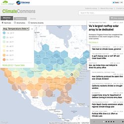
ArkGIS - Exploring the Arctic. Design a habitat - ARKive Education. Maps: Tools for Adventure - GIS in Action. Everest: Rivers of Ice. The World as 100 People. A dangerous Road. Virtual Hikes. Climate Commons. No Stories in ViewExplore the map or select more filter categories to bring stories back into view.
The Washington Times Apr 17, 2014. GeoCommons. MapMaker Interactive. Nature Soundmap. BBC Animated guides. Rising Seas - Interactive: If All The Ice Melted. Explore Shale geology, water, gas, oil. Dangers of Fracking. TerraClues on-line scavenger hunt. Geology of Britain viewer (BGS) Geology of Britain viewer The Geology of Britain viewer combines a number of key British Geological Survey data products in a single viewer.
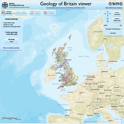
To facilitate this, the viewer can operate in one of four modes: To switch modes, use the 'Surface Geology', '3D Models', 'Borehole Scans' and 'Earthquake Timeline' buttons located under the banner. Surface Geology mode. Data Visualizations, Challenges, Community. Africa Map Puzzle. Europe Map Puzzle. Middle East Map Puzzle. Interactive Map of Europe, Europe Map with Countries and Seas. Europe is the second smallest of the inhabited continents.
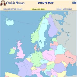
It is a part of the Eurasian land mass that includes Europe, Asia, Asia Minor and the Arabian Peninsula. As many large islands east and south of Asia are usually included in Asia, the Eurasian land mass extends from Iceland to New Guinea, from the Atlantic to the Pacific and from the Arctic to the Indian Oceans. World Panoramic Photography - 360 Cities. Geography games. Virtual Volcano Fieldtrips Oregon State University. Volcano Games Oregon State University. Six-figure grid references. GeoCommons. Darfur Is Dying - Play mtvU's Darfur refugee game for change. GKcontainer.
Ecological Footprint Quiz by Center for Sustainable Economy. Global Warming Interactive. Free Rice Game. LogiCity - Introduction. 50 Really Cool Online Tools for Science Teachers. A 21st-century education revolves around the Internet for everything from collaboration, tools, lessons, and even earning degrees online.
If you are looking for ways to integrate online learning into your science class or science degree programs, then take a look at these cool online tools that are just perfect for both teachers and students. Science Tools to Use with Students. Seismic Monitor. Jules Verne Voyager. Power Planets Game: Powering the Future. An Interactive Earthquake Engineering Resource for Middle Grade Students.
Student at computer This Web site was developed to provide middle school teachers with a comprehensive, single source education tool.
Connecte²d Teaching presents a unique real-life scenario in earthquake engineering design, offering students the opportunity to increase their understanding while motivating them to learn more, and to explore the fascinating world of STEM – science, technology, engineering, and mathematics. The site is divided into several interrelated sections covering a wide range of materials, with each area providing distinctive learning objectives. The Lesson Plans section contains materials that will engage students in authentic, disaster-related projects.
The Shake & Quake section is an interactive simulation tool, which allows the student to assume the role of structural engineer and to design a building. Earthquakes. Create a topographic profile. Import file (KML, KMZ, GPX) loaded layer and topographic profile of the route.
StatPlanet Map Maker ? Interactive Mapping & Visualization Software. Public Data Explorer. The Scale of the Universe. AmMap: Interactive flash maps. Enercities.