
Portable GIS - Open Source Computing and GIS in the UK. GIS on a USB stick.
Announcement: Portable GIS Version 4.1 is released (April 23rd 2014)! Download it here. Check your download against the provided md5 checksum. Note this is a copy.com link, so if the link doesn’t work it’s probably because the daily download limit has been reached. Please try again tomorrow! The philosophy behind this idea was to provide beginners with a ready-installed and configured stack of open source GIS tools that would run in windows without the need for emulation or a live cd.
Newly updated version 3.1 contains a self-contained installer, updated versions of all the constituent software packages, a new control panel, and improved documentation. The current set of software includes: The packages and menu system are all open source, but each component has a separate license. Provisoes: This is not for production use.
Support and Assistance: Portable GIS Google Group. TileMill.
Map. Mapnik. Mobile App Development Framework. JavaScript and HTML5. Download Sencha Touch Free. GXM/src/GXM at master · geoext/GXM. GeoExt 2 — JavaScript Toolkit for Rich Web Mapping Applications. Since version 2.1.0, GeoExt is based upon ExtJS 4 and ExtJS 5.
This means GeoExt can be used just like any other Ext 4/5 component, and applications making use of GeoExt 2.1 also profit from Ext JS enhancements like charting, a harmonized API with Sencha Touch, support for the MVVM-Pattern, 2-way-binding and a sophisticated single-file build tool. GeoExt 2 has been in the making for a long time, though most of the code has been written during a code sprint back in May 2012. We are deeply grateful that our sponsors helped make GeoExt 2 happen. Now, have a look at the examples below, read the API documentation, the API documentation (including ExtJS 4 classes) API documentation (including ExtJS 5 classes) or checkout the code. Geoext/geoext2.
Mf-geoadmin3/src at master · geoadmin/mf-geoadmin3. Map.geo.admin.ch.
Geopaparazzi by geopaparazzi. Geopaparazzi is a tool developed to do very fast qualitative engineering/geologic surveys.
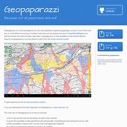
Even if the main aim is in the field of surveying, it contains tools that can be of great use also to OpenStreetMappers as well as tourists that want to keep a geo-diary. Geopaparazzi is now available on the Android Market. Search for geopaparazzi on your phone or get it from the online android market. To get started jump into the documentation section. If you are interested in the GIS integration of Geopaparazzi, check this doc out. The main aim of Geopaparazzi is to have a tool that: fits in any pocket and can be always at hand, when neededgives the possibility to take georeferenced and possibly orientated pictures during the survey, with further possibility to import them into the main GIS application BeeGISis able to exploit easily internet connection, if available.is extremely easy to use and intuitive, providing just few important functionalities.
The main features available in Geopaparazzi are: SpatiaLite: SpatiaLite. Untitled. Softwares de Geoprocessamento Gratuitos.