
Google Earth/KML Files. Real-Time EarthquakesDisplay real-time earthquakes, seismicity animations, and several real-time earthquake options including color by age/depth.
ShakeMapsMaps of ground motion and shaking intensity for significant earthquakes. Google Earth KML files are in the Downloads area for each individual earthquake under the GIS Files heading. Quaternary Faults & Folds in the U.S.Faults and associated folds in the United States that are believed to be sources of M>6 earthquakes during the Quaternary (the past 1,600,000 years). Earthquakes in CatalogView past earthquakes in Google Earth.
Search the ComCat earthquake catalog, and choose KML for the output format. Espace Pédagogique - "Seismic Eruption" : paramétrage, réalisati. EARTHQUAKE 3D. ENHANCED EDITION for Windows ComputersThe Enhanced Edition of Earthquake 3D is the most up to date version of this program and it contains many features which are not found in the free edition.
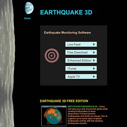
Enhancements include: Up to 30 days of Earthquakes, multiple data sources including USGS, EMSC, Geoscience, GeoNet, BGS, Geophon, and user supplied CSV data, four different Earth Images with better detail, automatic Earthquake Refresh Timer, Earthquake Alert Sounds with custom WAV file support, 'point and click' Earthquake Identification, six different View Preset Buttons, custom External Earth Images, Custom Colors, Lunar and Solar positions, Captions, and more...