
Digital collections. 360° Aerial Panoramas, 360° Virtual Tours Around the World, Photos of the Most Interesting Places on the Earth. Geographicus Rare Antique Maps. Kids World Travel Guide: Online Travel Guide for Kids and Parents. Amazing Planet. Flags of the World. Explore Georeferenced Maps - Spy viewer - National Library of Scotland. Latest Earthquakes.
Indus Valley. Latitude and Longitude Finder on Map Get Coordinates. Io: Compare two maps at the same scale. Geofabrik Tools. Travel book teacher guide. Young People's Trust For the Environment. Where do my meals come from? (5-8 years) BBC Bitesize - KS2 Geography - Where does our food come from? Build with Chrome. Old Maps Online. Compare United Kingdom To... Free SVG Maps - World. Britain from Above. Interactive Animations. This is our collection of interactive rollover flash animations.

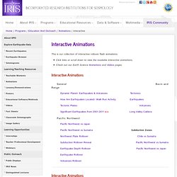
Click links or scroll down to view the available interactive animations.Check out our Earth Science Animations and Videos pages. Interactive Animations General Basin and Range Dynamic Planet- Earthquakes & Volcanoes Tectonics How Are Earthquakes Located- Walk Run Activity Earthquakes Tectonic Plates Volcanoes Significant Earthquakes from 2001-2011 NEW! Pacific Northwest Pacific Northwest vs Japan Pacific Northwest vs Sumatra Subduction Zones Northwest Plate Rollover Chile vs Sumatra Subduction Rollover Reveal Pacific Northwest vs Sumatra Earthquake Depth Rollover Pacific Northwest vs Japan Earthquake Rollover Volcanoes Rollover General Significant Earthquakes from 2001-2011 Download interactive Flash animation. Dynamic Planet- Earthquakes & Volcanoes Download interactive Flash animation.
How Are Earthquakes Located- Walk Run Activity Download IRIS one-pager, "How are earthquakes located? " Tectonic Plates Basin and Range Tectonics. Seismic Monitor - Recent earthquakes on a world map with regional zoom, headlines, and more. La erupcion del Vesubio. La destrucción de Pompeya. Geography Lesson: What is a Volcano? Volcanoes: Everything You Need. Earthquakes 101. National Geographic Kids. Magazine. Cultural Institute. Online Interactive Maps - Maps of all continents and U. S. Maps: Interactive Atlases, Continent and Country Maps, Print Maps, Resources. National Geographic Travel. Atlas Explorer. Skip to this page's content National Geographic Society P.O.

Box 98199 Washington, DC 20090-8199 USA Sign In Join Search National Geographic Search NationalGeographic.com Search Video Connect: Current Issue May 2014 Table of Contents » Atlas Maps Africa Geopolitical Geophysical Human Footprint Antarctica Geopolitical Asia Geopolitical Geophysical Australia Geopolitical Geophysical Europe Geopolitical Geophysical North America Geopolitical Geophysical South America Geopolitical Geophysical United States Geopolitical Geophysical Oceans Arctic Ocean Geopolitical Arctic Ocean Geophysical Antarctic Ocean Geophysical Atlantic Ocean Geophysical Indian Ocean Geophysical Pacific Ocean Geophysical Pacific Ocean Geopolitical National Geographic Atlas Explorer.
Mommy Maestra: Día de los Muertos, Day of the Dead Lesson Plans and Activities. Día de los Muertos is quickly approaching, so I thought I would share some of the many fabulous resources that I have discovered over the years.

Because this holiday is so popular, there is a growing number of lesson plans, units, and crafts now available on-line. Thematic Units: - By far, one of the best curriculum units has been created by Lori Langer de Ramirez, creator of MisCositas. It is geared for third year (intermediate) Spanish students. This is a comprehensive unit with 63 pages of activities, vocabulary, and more.
PRIMARY_national_curriculum_-_Geography. Google Maps 3D. Recce 3D Maps - discover the world around you. Recce - New York. Recce - San Francisco. Recce - London. Home - Sky Rainforest Rescue. Discovering Antarctica - teaching and learning resources on Antarctica. UK - Home. Sponsor a child today! Weather Forecast & Reports - Long Range & Local.
Volcano Videos : Videos. For Kids Only - Earth Science Enterprise. Beside the seaside. ePals. Barnaby Bear - Home. Maps. Welcome to Mapzone. OS GB Mapping from The Hug. Education and research. Old-Maps - the online repository of historic maps - home page. EarthCam - Webcam Network. Geograph Britain and Ireland - photograph every grid square!
Geographical Association - home. Maps. MapMaker Interactive. Give Geography its Place (GGiP) Videos: How We Make Chocolate, Chocolate Processing Videos. Schools Ages 4-11 - Geography Sites. KS2 Geography. KS1 Geography.