
How to Create a 3D Model From any Youtube Video using Photogrammetry. Creating a 3D model from a Youtube video (or any video for that matter) is simple, and yields some pretty amazing results.
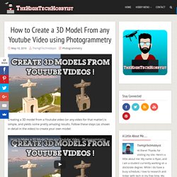
Follow these steps (as shown in detail in the video) to create your own model: Get familiar with photogrammetry.Find a Youtube video appropriate for photogrammetry. The best videos are usually aerial shots of a stationary object (statutes, buildings, landscapes, etc.). It is important that the footage shows a complete 360° view of the object.Screenshots need to be captured from the video.
Preferably around 50 images (look at photogrammetry tips) should be obtained from the video. Autodesk 123D Catch: Sign up is required, but it’s very quick and easy. Models can be turned into 3D printable files! Related. Ground Control Targets - Joe Wheaton. Photogrammetry with the DJI Phantom Vision 2 Plus. This article has been revised and updated.
A new step has been included to guide into lense correction. Another guide has also been included on using Pix4D Mapper Pro, – the only photogrammetry software which we recommend for use with the DJI if you want consistently good results. Examples from our tests were added. Thanks for all your feedback. (last updated August 27, 2015) I. ProgrammingBooks/Papers/Structure_From_Motion at master · bbfeechen/ProgrammingBooks.
DStretch.com home page. Lecture12. Lecture 12 1 Colour Image Processing The human visual system can distinguish hundreds of thousands of different colour shades and intensities, but only around 100 shades of grey.
Therefore, in an image, a great deal of extra information may be contained in the colour, and this extra information can then be used to simplify image analysis, e.g. object identification and extraction based on colour. Three independent quantities are used to describe any particular colour.
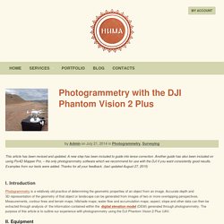
Archeo photogrammetry. Close Range Photogrammetry Documentation. 3D View of DEM Overlaid With 3D Breaklines Close Range Photogrammetry: Typical deliverables created as the end result of a CRP project could include 2D vector graphics (planimetric or elevation type CAD drawings), dense point clouds, 3D polylines, facetized models (mesh) of an object or surface, and raster graphics such as rectified or fully orthorectified images.
Each deliverable created should include appropriate metadata for each of the above mentioned steps, as well as metadata for the additional processing performed to create the final file. Because the diversity of possible end products and software packages associated with photogrammetry, it is difficult to specify the metadata required. We recommend using the ADS Guides to Good Practice to identify the appropriate metadata for your specific file. Using the Future to Understand the Past in the Present. Pole Aerial Photography. The continuous shooting technique, which we use with our kites, is also useful if you want to take pictures using the camera on a conventional monopod (or long telescopic or sectional pole).
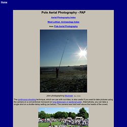
Alternatively, you can take a single shot on a shutter-delay setting (as below). The camera was held well above the heads of the crowd. Conventional monopod held above the crowd, 10 sec. shutter delay Since taking the above photo, we have bought some 8m sectional, fibreglass carp fishing poles (£18 - Seasonal from Aldi, often discounted to ~£6) and attached the top of a mini tripod. Avoid the similar, but weaker, flag poles. Arch Aerial at PfBAP - Dos Hombres.
Project Archaeocopter - The Flying Archaeologist. Background The acquisition of high-resolution, georeferenced imagery is a fundamental prerequisite for the detection and documentation of archaeological heritage.
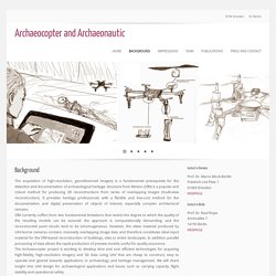
Structure from Motion (SfM) is a popular and robust method for producing 3D reconstructions from series of overlapping images (multi-view reconstruction). It provides heritage professionals with a flexible and low-cost method for the documentation and digital preservation of objects of interest, especially complex architectural remains. SfM currently suffers from two fundamental limitations that restrict the degree to which the quality of the resulting models can be assured: the approach is computationally demanding, and the reconstructed point clouds tend to be inhomogeneous. However, the video material produced by UAV-borne cameras contains massively overlapping image data and therefore constitutes ideal input material for the SfM-based reconstruction of buildings, sites or entire landscapes.
Quality - Easy to Use - Aerial Photography UAV's Drones. DJI Store. Using Software to Synthesise Data. Dan has put together a few screenshots of some of the awesome things that he has been doing as part of his dissertation work for the Masters in Archaeological Computing.
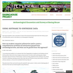
Dan’s dissertation topic is: How can modern computer software be used to create a comprehensive synthesis of information gained from archaeological sites, and what can be gained from this approach? In Dan’s own words: “I am seeing how possible it is to integrate data from Topographical, Geophysical and Building Survey, Old Excavation Data (in the form of paper and permatrace records as well as photographs), Digital Excavation Data (in the form of Total Station context recording, digitised section drawings, and context records in a database), photogrammetry data, Lidar data and Ordnance Survey data within a different software solutions. i.e Esri ArcGIS, AutoCAD Civil 3D and Map 3D.” Chris, Peter and Gareth using the ‘pole-camera’ 3D From Images (SfM, Photogrammetry)
Software. Kite and aerial images.